




Land surveying
Contents |
[edit] Introduction
Land surveying is a process for determining distances and angles between points on land. Land surveyors use traditional instruments and digital technology, to produce surveys, data and maps describing the Earth’s surface features. This is essential for civil engineering and construction projects.
Land surveying is a historic practice, with the first land surveys dating back nearly 3,000 years to Ancient Egypt, where surveyors subdivided fertile land around the Nile River after annual flooding.
Modern land surveyors use technology such as robotic total stations and theodolites to precisely map an area. This collected data can then be manipulated by computer aided design (CAD), building information modeling (BIM) or geographic information systems (GIS) software. For more information, see Surveying instruments.
[edit] Types of land survey
Land surveys can be divided into three basic categories:
- Standard land surveys: Describing boundary lines, calculating land areas, and so on.
- Engineering surveys: Ensuring a building is constructed in the correct place, and so on.
- Informational surveys: Used to create maps and charts.
Land surveys can also be classified as geodetic or plane surveys:
- Geodetic surveys tend to cover large areas, and must take into consideration the Earth’s curvature in order to achieve precision. These surveys require techniques such as triangulation and trilateration.
- By contrast, plane surveys consider the Earth’s surface as a flat plane, with curvature not taken into consideration. These tend to be used for smaller areas. Techniques required include plane trigonometry and plane geometry.
[edit] Land surveying uses
Land surveying can be used to establish boundaries for ownership. Information about boundaries is important as it helps determine where roads or buildings will be constructed, helps to settle property line disputes, and enables the development of land maps.
Other common uses of land surveying include:
- Initial surveys and environmental impact assessments of potential sites for construction.
- Geospatial measurement – charting exact coordinates of site features.
- Setting out - Establishing building lines and road alignments on site, as described by drawings (effectively the reverse of surveying).
- Photogrammetry – producing digital images of sites.
- Remote sensing – mapping land use with satellite photography.
- Geomatics – gathering data and using GIS to analyse and interpret site features.
- Geomechanics – monitoring land movement and subsidence as a result of construction works or natural processes.
- Draughting 2D and 3D charts and maps.
- Hydrographic surveying – gathering data for canals, dredging operations, navigational charts, oil and gas exploration, undersea mining, locating and salvaging sunken ships, and so on.
[edit] Land surveying techniques
The type of land survey technique adopted will depend the type of survey that is being undertaken.
[edit] Triangulation
Triangulation uses a series of connected triangles from which angles can be measured from determined stations. This is an efficient technique as it minimises the number of necessary measurements.
[edit] Trilateration
Trilateration calculates angles using electronic distance-measuring equipment to measure the lengths and sides of the triangles that are used in triangulation. This is often used in areas of uneven topography or rough terrain to produce more accurate calculations.
[edit] Traverse
The traverse technique uses a series of lines, of measured distances and lengths, that are connected together by points in determined locations. Traverse lines can be open or closed and adjusted to take account of obstructions, rough terrain, and so on. This is often used for the preliminary surveys of new roads.
[edit] Levelling
Levelling is the process of determining the height of one level relative to another. It is used in surveying to establish the elevation of a point relative to a datum, or to establish a point at a given elevation relative to a datum. The difference in elevation between two points can be established by using trigonometry.
[edit] Radiation
Radiation uses a fixed position above a ground location from which various points are taken at the boundary of the survey area. The points are plotted and distances measured and converted to the required scale on the survey sheet. It is most commonly used in conjunction with a plane table (a device used to provide a solid and level surface on which to make drawings, charts and maps), as well as with techniques such as traverse and triangulation.
[edit] How much does a Land Survey cost?
This is probably one of the most common questions asked by someone looking to get a survey done. It’s a question too complex to offer a simple answer to it. There are a variety of factors to be considered. Let’s try to break it down into the most common factors that influence the price of a survey.
- Size of the area in question. This is probably one of the most important factors to consider. The larger the area, the more expensive the survey becomes.
- Level of detail. This is specific to the type of survey you need. A simple diagram of land boundaries might not be as expensive as a full topographical survey.
- Legal fees. Often, when it comes down to boundary surveys or cadaster, there are fees associated with adding or amending the Land Registry of the local authority. These fees vary from place to place and the surveyor will add them on top of their quote.
- Urgency. More often than not, surveys then to be thought of last. Therefore they are required within short deadlines. And like everything else, time costs money.
Whilst there is no clear-cut answer on how much a survey will cost, you can take some precautions to make sure you don’t overspend. A few tips that might help include:
- Plan ahead of time and book the survey as early as you realise your project needs it. Don’t leave it to the last minute.
- Be clear with your requirements and communicate them to your surveyor. Mention what you need surveyed, to what level of detail, how the data should be presented, access requirements and purpose of the survey. This isn’t an exhaustive list, but provide any prior surveys or legal paperwork that is relevant.
- Don’t go for the cheapest surveying service you can find. Surveys are by nature precise products which require very well trained professionals to undertake. It is often the case that clients go for the cheapest solution, only to find themselves in the position that the survey is useless or not to the required specifications.
- Speak with multiple surveyors and ask for quotes. Find people with good references or trusted reviews.
[edit] External Links
https://geomatics.cc/articles/land-surveying-and-land-surveyors-755#Types_of_Land_Surveys
[edit] Related articles on Designing Buildings
- At grade.
- Building survey.
- Condition survey.
- Ecological survey.
- Geophysical survey.
- Geospatial.
- Global positioning systems and global navigation satellite systems.
- Ground control point GCP.
- Interview with Elly Ball, co-founder, Get Kids into Survey.
- ISO/TC 211 Geographic information/Geomatics.
- Laser scanning.
- Level.
- Levelling.
- Ley lines.
- Location and civil engineers.
- Minerals surveyor.
- Real time kinematic RTK.
- Road construction.
- Robotic total station.
- Site surveys.
- Soil survey.
- Surveying instruments.
- Surveyor.
Featured articles
Check out some of the best features and news from Designing Buildings as well as key stories from around the web.

Bringing together expertise and creating cultural benefits.

CIOB celebrates positive Ofsted report.

The Building Safety Regulator announces a call for evidence.

Government approach could undermine delivery and regeneration.
World's first mass timber data centre.
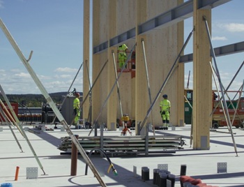
The overlooked environmental aspect of data centre development.
Introduction to radon awareness
New technical information sheet published by CIOB.

Updated supplier guide can help electrical contractors engage with NHP.

CIAT confirm the winners of the 2026 architectural technology awards.
Government launches a one stop shop for flood preparedness.

Sir Edwin Lutyens: Britain's greatest architect? Book review.
CIOB publishes free template to help assess and manage risks.
ECA's reflections on Party Conference season

Burnham wants to be confident of winning before asking for a fresh mandate.