





Boundaries to land and property

A boundary is a line that divides one area from another. It may also be called a border and defines the extent of one or more areas that are adjacent or in close proximity.
Boundaries can be defined physically by coastlines, rivers, roads, walls, fences and lines painted on the ground, or they can have no manifestation other than on maps, plans, charts and legal documentation. Boundaries between counties, administrative regions and nation states often appear only as lines on maps.
Boundaries are often the subject of disputes and may have perimeter security to prevent unauthorised access.
Title deed drawings tend to show which side of the boundary owns any physical structure such as a fence, using a ‘T’ symbol. Title deeds may also include agreements about ownership of, or responsibility for, boundaries, although these do not generally give any great detail, and are not always clear or accurate. For more information see: Responsibility for boundary features.
Construction sites often have strictly-defined boundaries comprising fences, hoardings and gates. These not only deter thieves and intruders, but also to protect the public from inadvertently straying into a potentially dangerous area.
The Construction (Design and Management) Regulations (the CDM Regulations) require the prevention of access by unauthorised persons to construction sites and that ‘… where necessary in the interests of health and safety, a construction site must, so far as is reasonably practicable, and in accordance with the level of risk posed, comply with either or both of the following; have its perimeter identified by suitable signs and be arranged so that its extent is readily identifiable; or be fenced off.’
Buildings may be designed to extend right up to boundary lines or be limited by building regulations to be sited a minimum distance away. Where buildings adjoin one another, works to the party structure are controlled by the Party Wall Act.
NB The Scottish Building Standards, Part I. Technical Handbook – Domestic, Appendix A Defined Terms, suggests that:
'Boundary means a boundary between land on which the building is situated and land in different occupation, so however that:
- in relation to any road , whether public or private, public access way or public right of way, river, stream, canal, loch, pond, common land or a public open space it should be taken to mean the centre line thereof; and
- the sea and its foreshore should not be regarded as land in different occupation.'
NB Land measurement for planning and development purposes, Guidance Note, Global 1st edition, Published by the Royal Institution of Chartered Surveyors (RICS) in May 2021, suggests that a boundary is : ‘The edge of a title area using either of the following methods.’
- ‘Fixed boundary method: fixed boundaries are a key feature of cadastral systems. They are usually single points marked on the ground with stones, posts or metal, enabling the linear boundary between them to be determined. The type of demarcation is stated in the technical description of the cadastral survey. Coordinates, distances, bearings and areas are noted on the cadastral survey plan and mirrored on the cadastral index map.’
- ‘Determined boundary method: determined boundaries are a feature of land registration in the UK and some British Commonwealth countries, and are where boundaries identified under the ‘general boundaries’ principle are established on the ground and recorded. For example, in England and Wales the requirement is to record a boundary’s position to a precision of +/- 10mm. The determined boundary should be mapped relative to surrounding ‘hard’ detail (any feature made of brick, stone or concrete that is expected to endure) to a high level of accuracy that is certified by a chartered land surveyor. The intention is that another chartered land surveyor would be able to relocate the boundary. A determined boundary should be agreed between the neighbouring landowners before it is recorded in the land register.’
See also: General boundaries.
NB Approved document S, Infrastructure for the charging of electric vehicles, published in 2021 by HM Government, defines a boundary as: ‘The boundary of the land and/or buildings belonging to and under the control of the building owner.’
It defines the site boundary as: ‘The boundary of the land in relation to a building, in respect of which building work is being carried out, means the boundary of the land, upon which that building is situated, that is controlled or owned by the same person who owns:
- ‘that building, or
- in the case of the erection of a new building, the land upon which building work is being carried out.’
International Land Measurement Standard: Due Diligence for Land and Real Property Surveying, 1st edition, published by the International Land Measurement Standard Coalition in May 2019, defines a boundary as: ‘A line that marks the limits of an area. Boundaries can be a Physical Boundaries and Legal Boundaries, which are not all coincident and take many forms. This includes straight or curvilinear surfaces between known coordinated points or Physical Boundaries based on physical features.’
See also:
[edit] Related articles on Designing Buildings
Featured articles and news

We're expanding our collaborative mission by launching DB Intelligence, an exclusive market research advisory panel. Built environment professionals can now get paid to share their expertise on industry trends, products and services.
Panel members receive direct financial incentives for participating in research projects like short surveys, 1-2-1 interviews and focus groups. Register today to shape the future of the construction sector.
Social media ban consultation comes to close

CIOB urges UK Government to consider social media’s role in careers guidance in ban debate.
The latest of eight Skills England apprenticeship units

The addition of battery manufacturing welcomed by ECA with a warning about the risks of fast-tracked apprenticeship units.
Building Control Independent Panel final report
A precis of a key report led by Dame Hackitt with full recommendations and link to the government response.
Guide to ISO 19650 for Architecture Firms (2026)
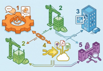
A user gives their low down.

A UK training and membership provider for mould remediation professionals.
Building Safety recap April, 2026
A short and longer run-through of the month, with links to further information and sources.
CIAT May 2026 briefing.

Independent NSI and BAFE study exploring how organisations are changing the way they buy fire safety services.

From medieval scribes to modern word art.

ECA welcomes crackdown on late payment and push for clean energy, whilst CIOB seek fixed cladding removal timeframes.
Cyber Security in the Built Environment
Protecting projects, data, and digital assets: A CIOB Academy TIS.
Managing competence in the built environment

ITFG publishes new industry guide on how to meet the ICC principles.
The UK's campaign to reduce noise pollution: Mythbusting, articles and topic guides.
Comments
[edit] To make a comment about this article, or to suggest changes, click 'Add a comment' above. Separate your comments from any existing comments by inserting a horizontal line.