Chalk aquifer

|
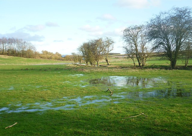
| After a winter of heavy rainfall, the chalk aquifer which feeds the River Pang can become saturated, causing the groundwater to rise in many springs and pools. In 2014, the westernmost sources of the Pang rose beyond West Ilsley, and the usually dry upper sections of the Pang flooded roads and houses in villages along its course. |
Contents |
[edit] Introduction
An aquifer is a geological formation that holds groundwater. The term 'groundwater' refers to all water which is below the surface of the ground and within the permanently saturated zone. A groundwater body is a distinct volume of groundwater within an aquifer, which is sufficiently porous and permeable to store and yield a significant quantity of water to a borehole, well or spring.
The properties of aquifers depend on their composition. The most important properties are porosity and yield. These characteristics dictate the aquifer’s capacity to release water through pores and influence its ability to transmit water.
[edit] What is the Chalk?
There are chalk aquifers throughout the world. However, one specific chalk aquifer, known as the Chalk, is the major aquifer of southern and eastern England. It supports the Thames Basin and the London aquifer.
The Chalk stretches from the south east of Yorkshire south into Lincolnshire. It spans across central southern England from north Norfolk through the Thames Basin and along the Kent coast to the Isle of Wight and into Dorset. It is associated with the iconic scenery of the white cliffs in and around Dover.
[edit] Characteristics of the Chalk aquifer
The Chalk aquifer has an interconnected network of fractures. Yields of approximately 150 litres per second are the highest where the density of fractures is greatest and/or where the fractures are enlarged. Most of the Chalk aquifer's storage comes from the secondary porosity of these fractures.
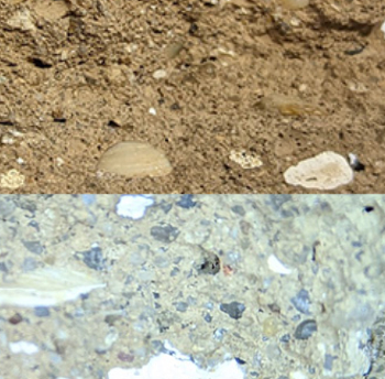
Made of microporous white limestone with layers of flint, the Chalk is a type of calcareous clay. Its composition also includes shells and plankton.
Its unusual structure has well developed fissures that are between 0.5 to 2% of their total volume, giving them a higher permeability. It also has low matrix permeability, which prevents water from draining quickly.
[edit] Vulnerability
Problems may occur in places where porewater found in the Chalk aquifer contains saline (such as in the Thames Basin and across East Anglia). In some regions, this can result in contamination of groundwater, particularly in areas where excessive aquifer pumping takes place.
The Chalk aquifer is susceptible to pollution from nitrates and other pesticides associated with agricultural activity. It can also become contaminated by industrial chemical leakage.
However, due to the long “lag-time” (it can take up to 40 years before undesirable pollutants leach into the soil and enter the water supply), the Chalk has been subject to specialised engineering models that simulate how these toxic materials work their way into the groundwater. Modelling has influenced decisions to increase investment in in-situ aquifer treatment.
[edit] The London Basin Chalk Aquifer management plan
In August 2018, the Environment Agency published the latest status report on the management of the London Basin Chalk Aquifer. The reports, which began in the 1990s, document the rise in groundwater levels and outline a management plan to protect the aquifer as a sustainable, secure and high-quality water resource while protecting infrastructure from floods.
The 2018 report found that reduced groundwater levels have eroded the natural groundwater outlet in the centre of the London Basin. This has resulted in the intrusion of saline river water from the tidal Thames and could lead to the release of sulphate-rich, acidic groundwater through pyrite oxidation. The impact of this requires additional research.
A group of experts were assembled in 1992 to manage the London Basin. The General Aquifer Research Development and Investigation Team (GARDIT) developed a strategy with five phases:
- Phase 1 - Thames Water to re-commission disused sources.
- Phase 2 - Thames Water to develop proven existing boreholes.
- Phase 3 - Private, commercial boreholes.
- Phase 4 - Thames Water to create new borehole sites in central area.
- Phase 5 - Thames Water to create new borehole sites in outer area.
The GARDIT strategy achieved its goal in 2000, however, subsequent data suggests levels will require continual artificial management.
[edit] Related articles on Designing Buildings
- Anisotropic.
- Aquifer.
- Aquitard.
- Clunch.
- Fertilizer groundwater pollution.
- Flint.
- Groundwater.
- Groundwater control in urban areas.
- Holloway.
- How adaptive planning is being used to future-proof water supplies in the South East.
- Isotropic.
- Thames barrier.
[edit] External resources
Featured articles and news
UKCW London to tackle sector’s most pressing issues
AI and skills development, ecology and the environment, policy and planning and more.
Managing building safety risks
Across an existing residential portfolio; a client's perspective.
ECA support for Gate Safe’s Safe School Gates Campaign.
Core construction skills explained
Preparing for a career in construction.
Retrofitting for resilience with the Leicester Resilience Hub
Community-serving facilities, enhanced as support and essential services for climate-related disruptions.
Some of the articles relating to water, here to browse. Any missing?
Recognisable Gothic characters, designed to dramatically spout water away from buildings.
A case study and a warning to would-be developers
Creating four dwellings... after half a century of doing this job, why, oh why, is it so difficult?
Reform of the fire engineering profession
Fire Engineers Advisory Panel: Authoritative Statement, reactions and next steps.
Restoration and renewal of the Palace of Westminster
A complex project of cultural significance from full decant to EMI, opportunities and a potential a way forward.
Apprenticeships and the responsibility we share
Perspectives from the CIOB President as National Apprentice Week comes to a close.
The first line of defence against rain, wind and snow.
Building Safety recap January, 2026
What we missed at the end of last year, and at the start of this...
National Apprenticeship Week 2026, 9-15 Feb
Shining a light on the positive impacts for businesses, their apprentices and the wider economy alike.
Applications and benefits of acoustic flooring
From commercial to retail.
From solid to sprung and ribbed to raised.
Strengthening industry collaboration in Hong Kong
Hong Kong Institute of Construction and The Chartered Institute of Building sign Memorandum of Understanding.
A detailed description from the experts at Cornish Lime.


