


Mobile mapping technology
Mobile mapping technology involves capturing geospatial information using mobile vehicles such as cars, aeroplanes, boats, or even golf carts. These systems are equipped with advanced imaging tools, inertial measurement units (IMU), and inertial navigation systems (INS), along with radars, laser scanners, cameras, and speed sensors. These components work together to provide accurate visualisation, recording, and measurement of surrounding environments. A significant advantage of mobile mapping is its ability to quickly chart difficult-to-access locations, making it a valuable tool for various industries.
One of the key drivers behind mobile mapping's growth is its efficiency compared to traditional methods like aerial photogrammetry, which is time-consuming and costly. Many companies are shifting to mobile mapping for applications such as cable network installation, fleet management, asset tracking, and maintenance due to its faster data delivery and lower costs. Compared to conventional terrestrial surveying and point-wise GPS, mobile mapping offers enhanced productivity, precision, and safety, making it an attractive choice for businesses and government agencies alike.
Additionally, the increasing integration of mobile mapping technology into smartphones is accelerating market expansion. Many smartphone manufacturers are incorporating motion sensors and affordable GPS receivers, enabling users to determine their locations within a few meters. Furthermore, rapid advancements in satellite mapping technology and rising global smartphone sales are further driving the adoption of mobile mapping. As these technologies continue to evolve, the global mobile mapping market is expected to experience sustained growth and innovation in the coming years.
New Research on The Mobile Mapping Market (Brainy Insights) offers an in-depth analysis of the market, including overall size, share, and product definitions. It also delves into supply chain analysis, examining supply chain ratio, upstream raw materials and equipment, downstream demand analysis, and detailed import/export information.
The global mobile mapping market is projected to reach USD 141.1 billion by 2032, growing at a compound annual growth rate (CAGR) of 18.9% from 2023 to 2032. This rapid growth is driven by the increasing demand for precise geospatial data across various industries. The Asia-Pacific region is expected to witness the fastest expansion during the forecast period, fuelled by technological advancements, infrastructure development, and the rising adoption of mobile mapping solutions.
Market Summary on The Basis Of The Type, The Market Has Been Bifurcated Into
by Offering:
- Solution
- Service
Based On The Application / End Users, The Market Has Been Divided Into
by Application:
- Imaging Services
- Facility Management
- Aerial Mobile Mapping
- Internet Application
- Emergency Response Planning
- Satellite
Top Leading Companies:
Microsoft Corporation, Pasco Corporation, Qualcomm Inc., EveryScape Inc., Mitsubishi Electric Corporation, Trimble Inc., Google LLC, Black & Veatch, Apple Inc., GeoSLAM, Leica Geosystems, Hexagon AB, Novatel Inc, Foursquare Labs, Javad GNSS Inc., Teledyne Optech LLC, MapJack
[edit] Related articles on Designing Buildings
- Asset information model.
- Base map.
- BIM and facilities management.
- BIM articles.
- BIM glossary of terms.
- Cartogram.
- Cartography.
- Choropleth map.
- Composite map.
- Construction Operations Building Information Exchange (COBie).
- Common data environment.
- Digital mapping and cartography.
- DIgital mapping.
- Geographic Information Systems: QGIS.
- Geospatial.
- Global positioning systems and global navigation satellite systems.
- ISO/TC 211 Geographic information/Geomatics.
- Isovist mapping.
- PAS 1192-3:2014.
- Site mapping or feature mapping.
- Stakeholder maps.
- Underground asset register for Britain.
Featured articles
Check out some of the best features and news from Designing Buildings as well as key stories from around the web.
Building Safety Act implementation in Wales

CIAT to host industry panel on 26 June.
![]()
New and updated CLC building safety guidance.
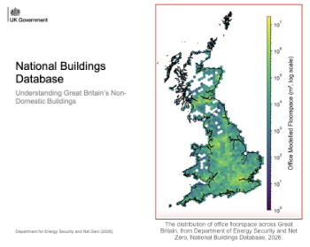
New UK National Buildings Database.
Building Safety Wiki Interviews

Chief executive of the British Woodworking Federation.
Planning condition discharge in England and Wales

A brief explanation from a building compliance expert, with further links.
Overheating guidance and tools for building designers

Guidance for dealing with element of building fabric control that have increasing importance.
Shading for housing, a design guide

From the Good Homes Alliance and British Blind and Shutter Association.
UK Standard Skills Classification (SSC)

A shared framework for describing skills needs.
Social media ban consultation comes to close

CIOB urges UK Government to consider social media’s role in careers guidance in ban debate.
The latest of eight Skills England apprenticeship units

The addition of battery manufacturing welcomed by ECA with a warning about the risks of fast-tracked apprenticeship units.
Building Control Independent Panel final report

A precis of a key report led by Dame Hackitt with full recommendations and link to the government response.