Remote sensing
Remote sensing in general means the detecting of information from a distance. More specifically the surface of the earth can be observed and in many cases monitored through the use of satellites or aircraft carrying specialist equipment. This equipment ranges from video and photographic equipment to laser scanning (lidar) and sensor equipment that can detect and record distances accurately as well as reflected or emitted energy.
The earliest and simplest form of remote sensing was the aerial photograph, which gave the opportunity to see for the first time large areas of land use from above, it became an important tool in recording historical landscape changes but also in planning future uses. As the resolution of images has improved along with tools enabling better interpretation and analysis, satellite imagery continues to be an important tool in governance, urban planning and architecture.
Other more specialist remote sensing tools such as radiometers measure electromagnetic energy produced by the vibration of charged particles to analyse changes in the surface and atmosphere of the earth. Spectrometers analyse the surface and atmosphere of the earth using light (either from the sun or from their own source). These passive and active sensors combined have the ability to measure land and sea surface temperature, vegetation properties, cloud and aerosol properties, physical attributes, forest structure, precipitation and wind, sea surface topography, ice among other characteristics.
Remote sensing as a core element of Geoinformatics is seen as an opportunity to better inform the field of urban planning with various free geographic information tools becoming openly available benefiting from both Geographic Information Systems (GIS) in combination with remote sensing.
The Copernicus Land Monitoring Service - Urban Atlas, developed by the European Union is one such tool, as well as the interactive UK Geoinformation tool MAgiC. Links to both tools are given below.
- https://www.eea.europa.eu/data-and-maps/data/copernicus-land-monitoring-service-urban-atlas
- https://magic.defra.gov.uk/
Whilst Google Maps and Google Earth are commonly used tools, they to some extent give access to historical aerial photographic data. Whist the Aerial Photo Explorer recently released by Historic England gives access to mapped historic aerial photographs across the UK.
- https://earth.google.com/web/
- https://historicengland.org.uk/images-books/archive/collections/aerial-photos/
NB The glossary of statistical terms, published by the Organisation for Economic Co-operation and Development (OECD), defines remote sensing as: ‘The process of acquiring information about an object from a distance; i.e. without physical contact. Remote sensing usually refers to image acquisition by means of satellite sensors or aerial photography.
[edit] Related articles on Designing Buildings
- 3D city model.
- 3D printer.
- BIM for heritage asset management.
- Building information modelling.
- Building survey.
- Construction cameras.
- Construction drones.
- Desk study.
- Development appraisal.
- Drones as a Service DaaS.
- Geophysical survey.
- Global positioning systems and global navigation satellite systems.
- Ground control point GCP.
- How can drones transform construction processes?
- How to layout a building.
- Impulse radar.
- Innovation and investigation at the Hill House.
- Interview with David Southam about laser scanning in construction.
- Laser.
- Laser scanning for building design and construction
- Pre-construction information.
- Radar.
- Site information.
- Site surveys.
- Surveying instruments.
- Surveyor.
- Technical due diligence.
- Uses of drones in construction.
- Vendor survey.
Featured articles and news
The UK’s largest air pollution campaign.
Future Homes Standard, now includes solar, but what else?
Will the new standard, due to in the Autumn, go far enough in terms of performance ?
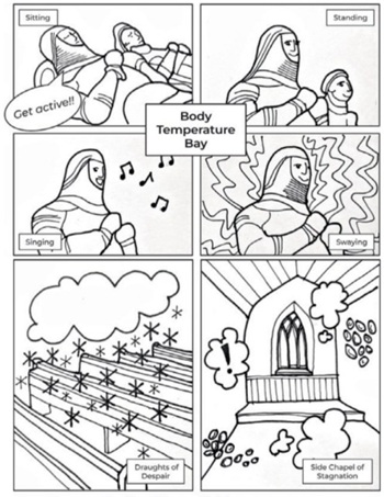
BSRIA Briefing: Cleaner Air, Better tomorrow
A look back at issues relating to inside and outside air quality, discussed during the BSRIA briefing in 2023.
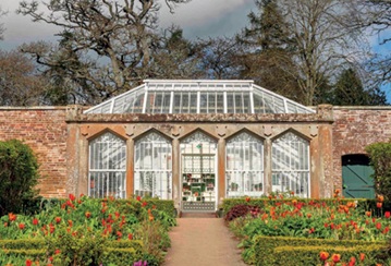
Restoring Abbotsford's hothouse
Bringing the writer Walter Scott's garden to life.
Reflections on the spending review with CIAT.
Retired firefighter cycles world to raise Grenfell funds
Leaving on 14 June 2025 Stephen will raise money for youth and schools through the Grenfell Foundation.
Key points for construction at a glance with industry reactions.
Functionality, visibility and sustainability
The simpler approach to specification.
Architects, architecture, buildings, and inspiration in film
The close ties between makers and the movies, with our long list of suggested viewing.
SELECT three-point plan for action issued to MSPs
Call for Scottish regulation, green skills and recognition of electrotechnical industry as part of a manifesto for Scottish Parliamentary elections.
UCEM becomes the University of the Built Environment
Major milestone in its 106-year history, follows recent merger with London School of Architecture (LSE).
Professional practical experience for Architects in training
The long process to transform the nature of education and professional practical experience in the Architecture profession following recent reports.
A people-first approach to retrofit
Moving away from the destructive paradigm of fabric-first.
International Electrician Day, 10 June 2025
Celebrating the role of electrical engineers from André-Marie Amperè, today and for the future.
New guide for clients launched at Houses of Parliament
'There has never been a more important time for clients to step up and ...ask the right questions'
The impact of recycled slate tiles
Innovation across the decades.
EPC changes for existing buildings
Changes and their context as the new RdSAP methodology comes into use from 15 June.


