3D city model
Contents |
[edit] Introduction
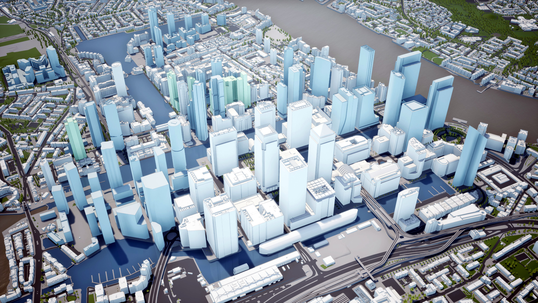
3D city models are more than the simple evolution of paper maps. Accurately mapping a 3rd dimension provides a cornerstone dataset for a number of industries, and 3D city models already play a role in planning and architecture. This role will continue to evolve, as planning for future urban transport systems, smart cities and even AI-driven energy-saving systems will all rely on accurate 3D city models.
[edit] Extruded footprint polygons
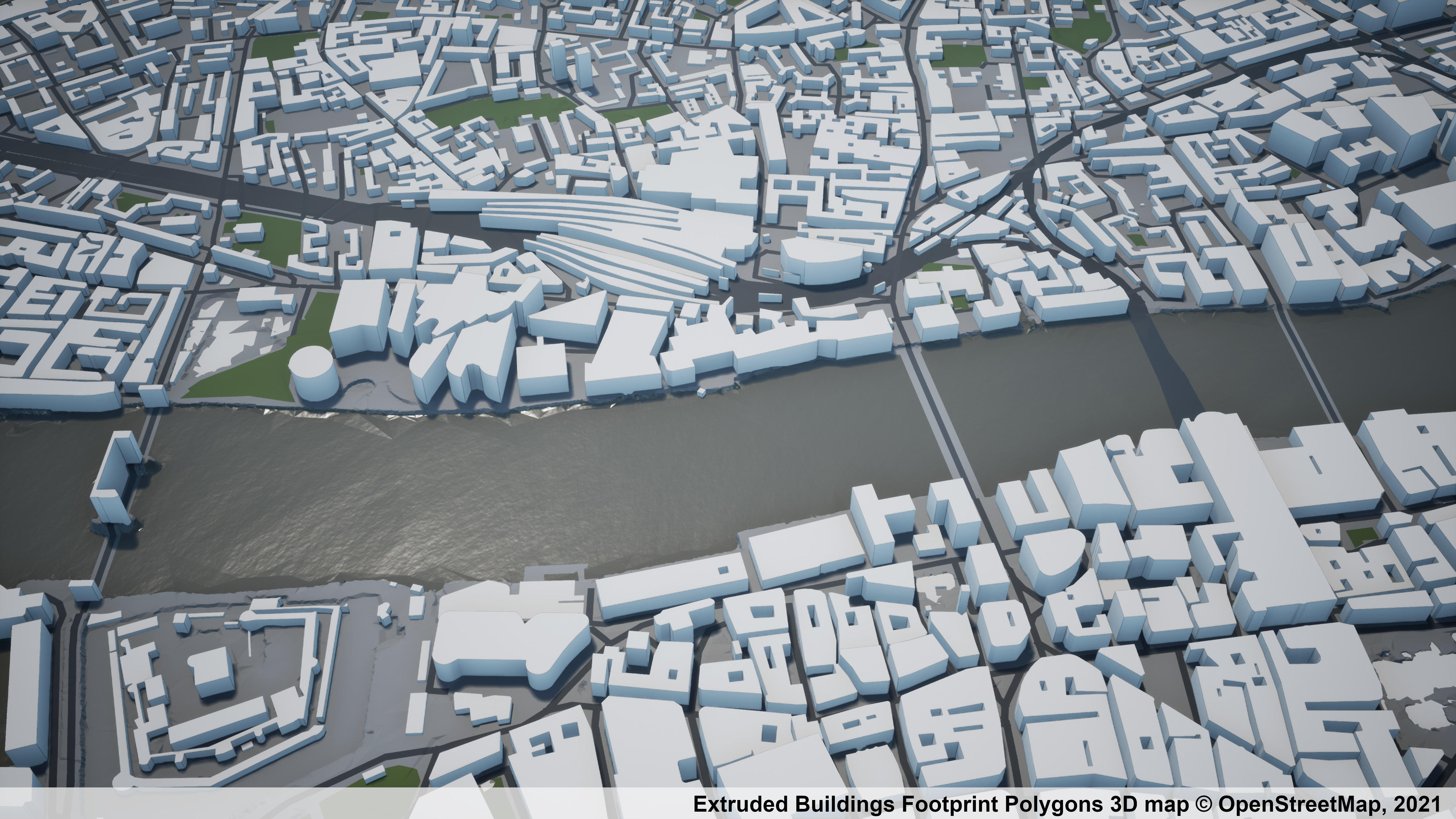
Extruding buildings footprint polygons is one way of adding a third dimension to 2D mapping data. In essence, the technique is taking an estimate of a building’s height and extending the footprint vertically to that height.
[edit] Digital surface models
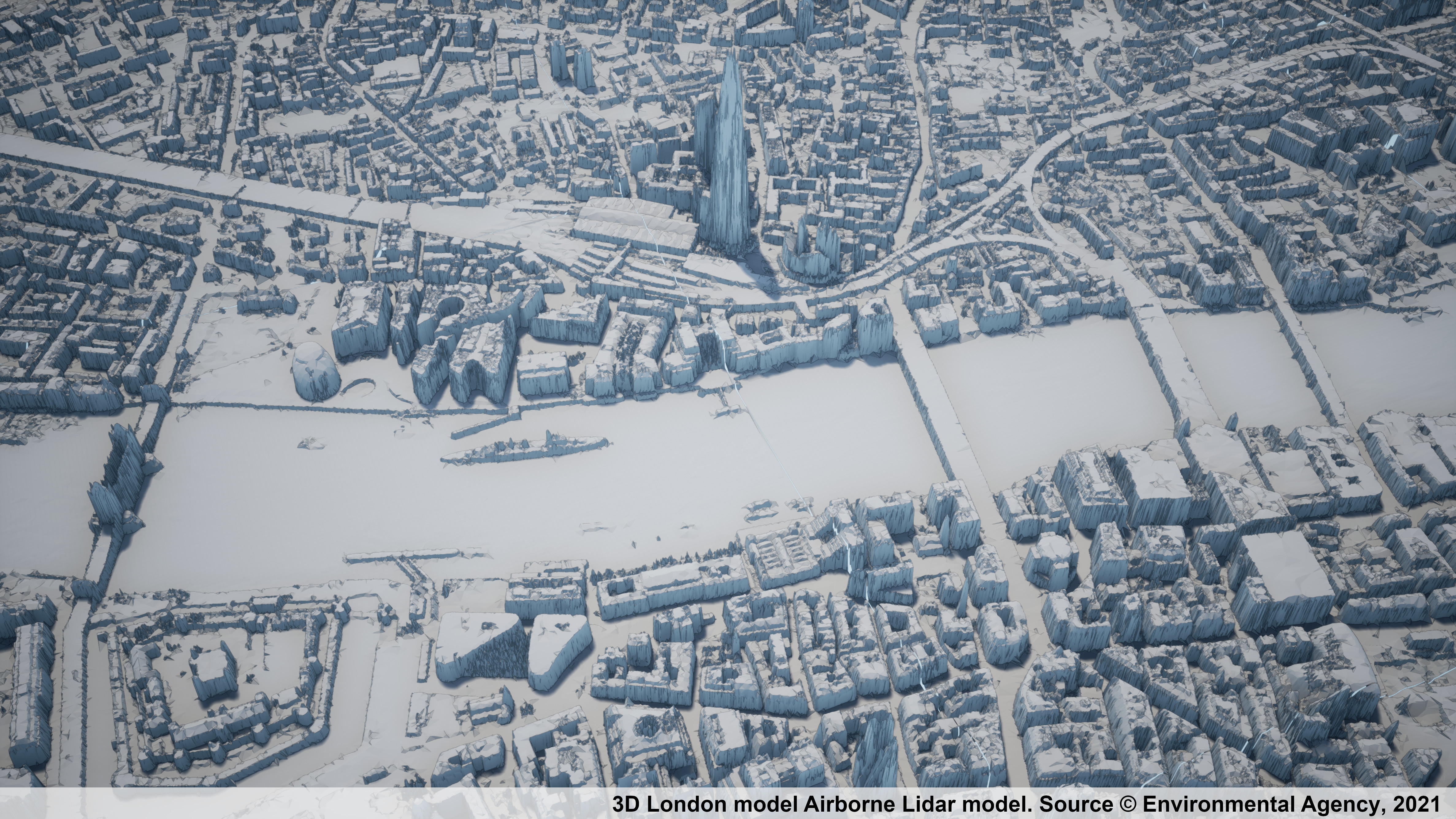
Digital surface models (DSM) can be created by pixel-matching of aerial photography or by creating a mesh from an airborne LIDAR. Taking raw LIDAR data and turning it into a 3D model with no additional information, such as a building’s polygons, is an essentially automated process. Users can download the source data in the raw LAS format to create DSMs).
[edit] Source imagery survey data
Both drone-based and satellite-imagery photogrammetry technology have potential. Drones can produce 3D models which can then be combined to create wide-area 3D city models.
Civilian satellites currently offer limited use in major world cities, but with better resolution available, it should be possible to substitute aerial surveys for satellite surveys in the foreseeable future.
[edit] Manual aerial photogrammetry
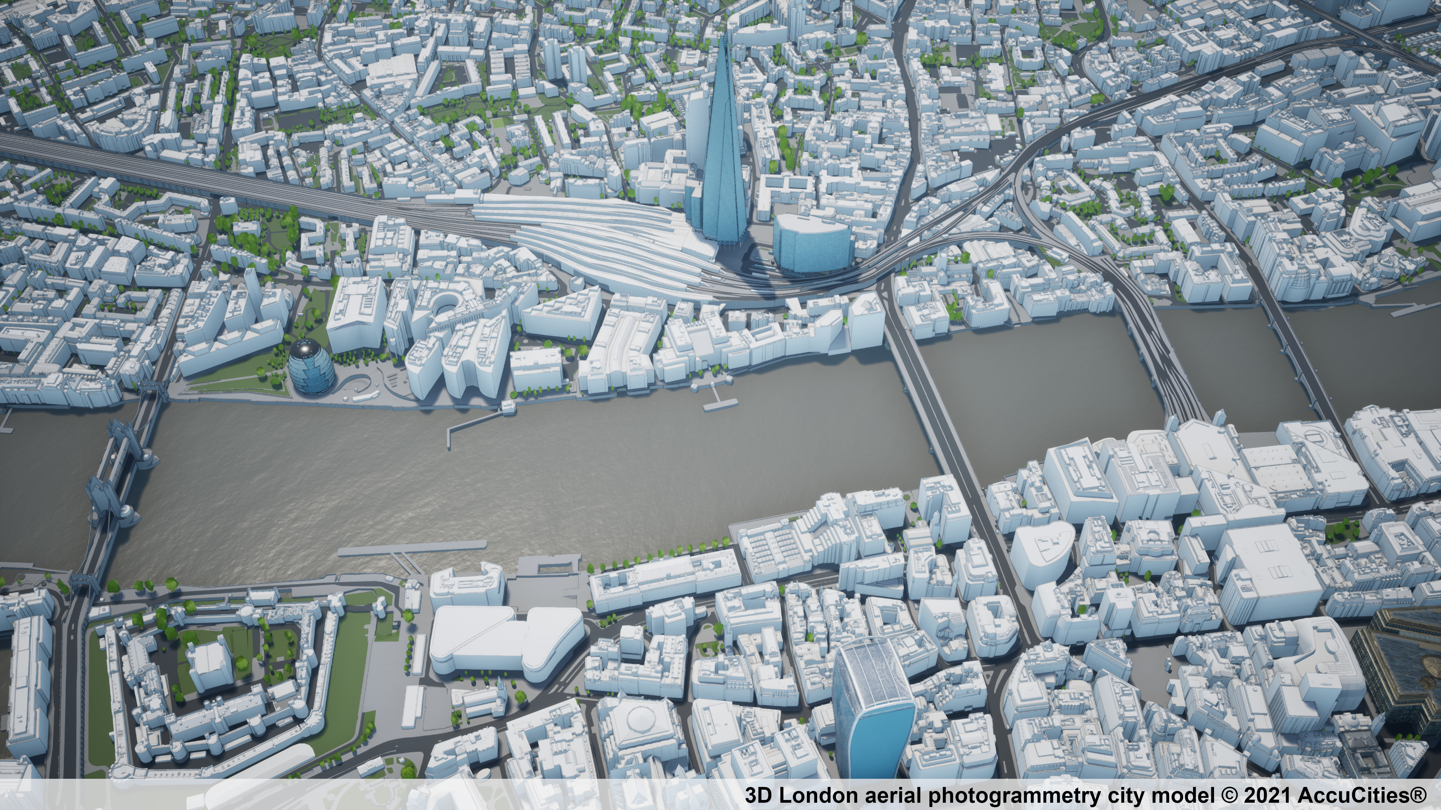
Manual stereo photogrammetry is generally accurate and detailed. The 3D models produced are usable and, once the project is set-up, various levels of detail can be captured. There are several way to collect source data, but the downside is that it’s a manual process and can be expensive in terms of time and resources.
3D London model by AccuCities is one example of a large 3D city model captured using stereo photogrammetry from fixed-wing aircraft. These 3D models can be captured and delivered as AutoCad, Sketchup or FBX files and can be directly imported into 3D editing software.
[edit] Textured aerial photogrammetry
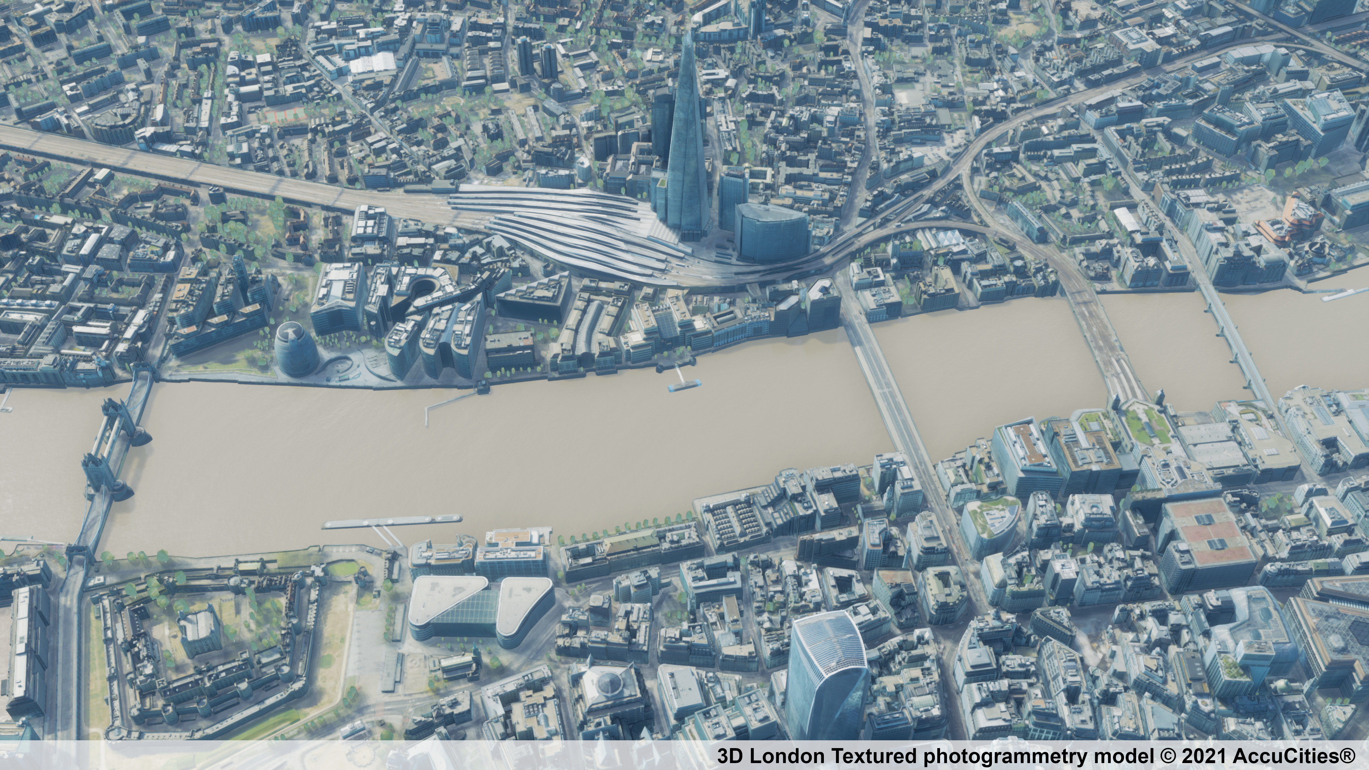
The Textured photogrammetry model is made out of textures applied to clean geometry. It’s an accurate city model with high visual fidelity. Good example is the Textured 3D London model by AccuCities.
Because the textures are applied onto a separated high detail photogrammetry model, users can turn textures on and off on buildings, terrain, or on any other features. Pixel stretchings and imperfections, occurring mostly in urban canyons, can be rectified on focus buildings by upgrading a UV map from custom photographs.
[edit] Non-GIS Game-ready model
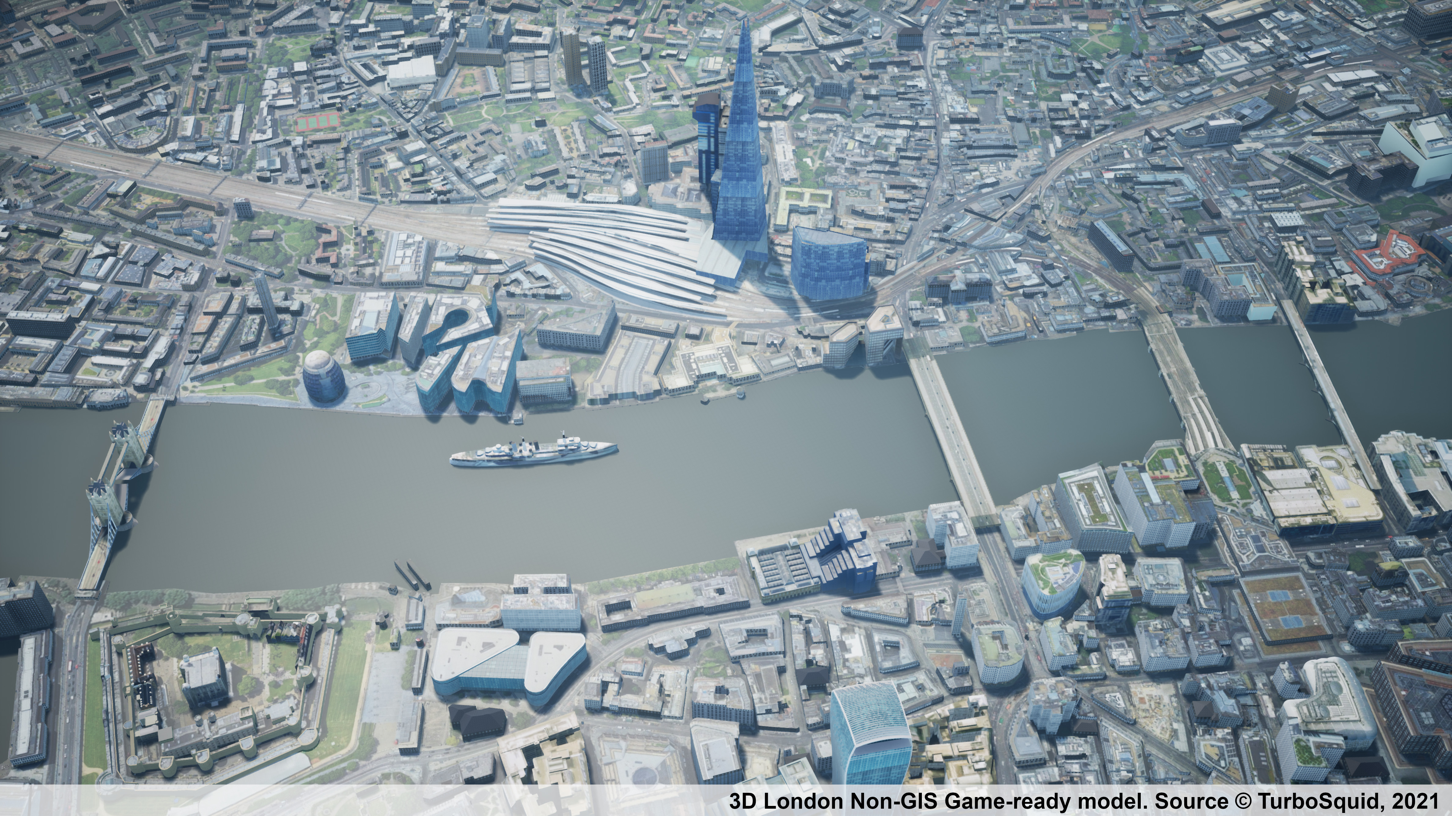
An inexpensive game-ready model might offer a good alternative to accurate, GIS-based city models. The datasets are not made for architecture or urban planning but can be highly affordable with a surprising level of detail on landmark buildings.
If you opt to use a non-gis game model, be weary of different 3D city models used in games. 3D city models for videogames were historically only rarely used in architecture; mainly because until very recently they were only vaguely based on actual cities. Recent game-ready models do offer an attractive and affordable option for many applications that require recognisability rather than high accuracy
[edit] 3D city models by Google
Structure-from-motion (SfM) pipeline for visual 3D modelling of a large city area uses a 360° field of view Google Street View images. The core of the pipeline combines techniques such as SURF feature detection, tentative matching by an approximate nearest neighbour search, relative camera motion estimation by solving five-point minimal camera pose problem and sparse bundle adjustment.
[edit] 3D printed city models
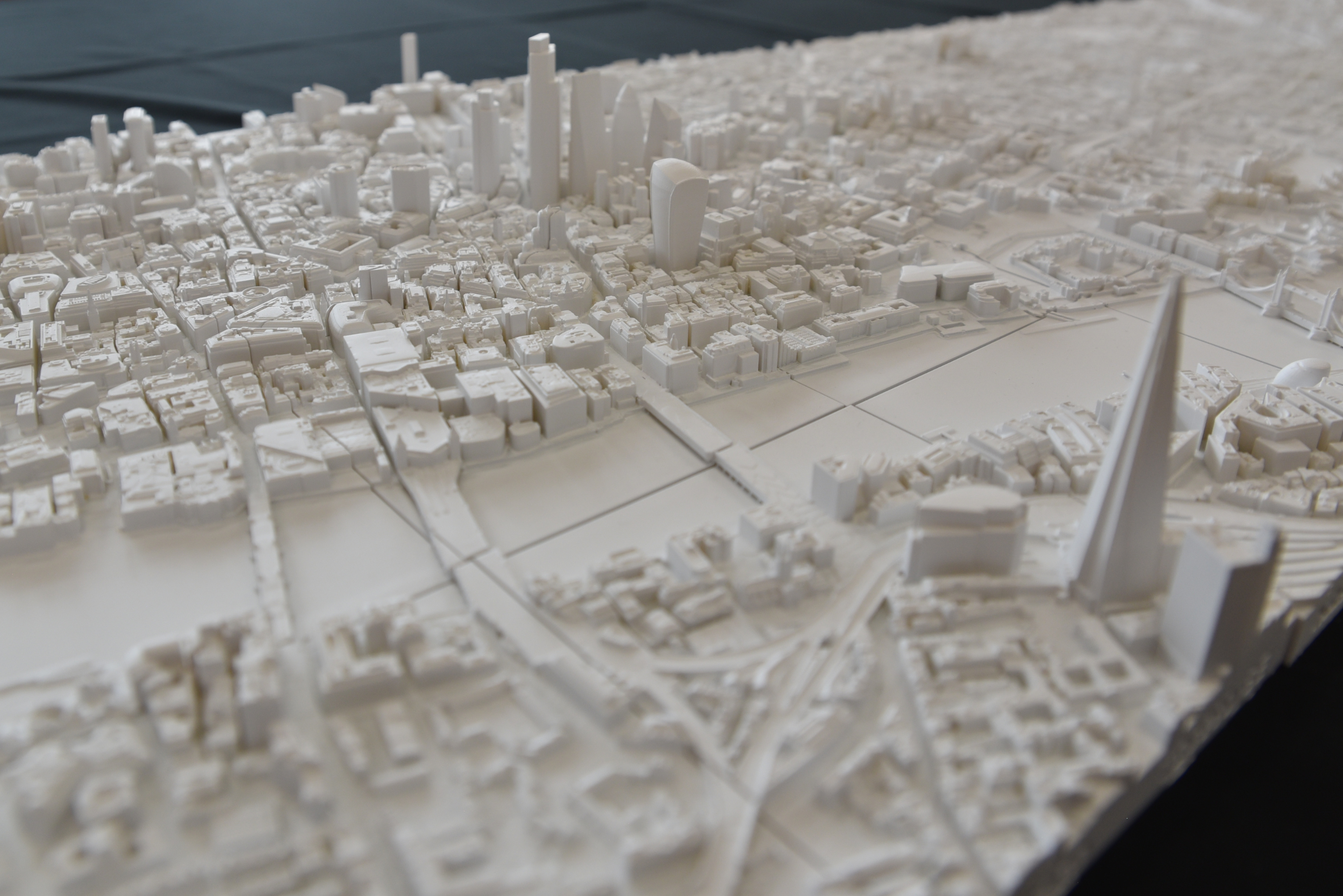
3D printed city models are usually produced by local authorities, architects, urban planners and other customers who require a physical representation of an area of a city. Often used as a three-dimensional map and valuable especially to assess the impact of tall buildings on the overall city environment.
The model can be 3D printed on a small-volume 3D printer. On this example, AccuCities and Hobs3D have 3D printed a large-scale 3D printed model of London in interchangeable 10×10 cm tiles (each tile covers 500 x 500 meters of the real-world environments). Any particular area can be easily and affordably manipulated and replaced.
[edit] Related articles on Designing Buildings
BIM Directory
[edit] Building Information Modelling (BIM)
[edit] Information Requirements
Employer's Information Requirements (EIR)
Organisational Information Requirements (OIR)
Asset Information Requirements (AIR)
[edit] Information Models
Project Information Model (PIM)
[edit] Collaborative Practices
Industry Foundation Classes (IFC)


