


Geophysical survey
Contents |
[edit] Introduction
A geophysical survey is a cost-effective, non-intrusive and relatively efficient means of detecting and assessing sub-surface features. Geophysical surveys are capable of covering large areas at low cost by taking readings between widely spaced borings to detect and locate changes in sub-surface materials or stratification. They are useful for extended sites where conditions are generally favourable and are widely-used in the support of planning applications.
There are a wide variety of geophysical techniques available for measuring different physical properties, with different levels of sensitivity to different types of feature. The site-specific conditions and the type and composition of likely features will determine the suitability of a particular technique.
The most commonly-used geophysical survey techniques:
- Electrical resistivity.
- Seismic refraction and reflection.
- Magnetometry.
- Ground-penetrating radar (GPR).
[edit] Electrical resistivity
Electrical resistivity surveys detect the difference in electrical resistance between different rock or soil types. They are able to detect features such as swallow holes or underground cavities, and analysis of the results can establish the thicknesses and depths of the various sub-strata.
The method involves passing a small electrical current through equally-spaced electrodes on the surface. By varying the electrode centres, the penetration depth can be varied. The recorded differences in relative resistance are used to map features such as voids, ditches, pits and structural features. This is useful in situations where magnetometry is unsuitable, however, it can be more time-consuming and problems can occur if conductors such as pipes and cables are present, as these can make the survey results unreliable.
[edit] Seismic refraction and reflection
Seismic refraction and reflection involves propagating vibrations with a ‘sledgehammer’ and measuring the time taken and the distance covered by the shock waves. Shallow exploration tends to favour the refraction method, whereby seismometers are spaced at increasing distances from the vibration source with the shock waves plotted against a time scale.
The reflection method is suited to exploration depths of greater than 150 m. Both methods are useful for determining the change in soil type and for surveying sites for tunnels, dams and harbour works.
[edit] Magnetometry
Magnetometry is based on measuring the variations in intensity and direction of the earth’s magnetic field and is capable of providing a rapid, detailed assessment of a large area. Anomalies in the vertical component of the earth’s magnetic field can be detected, which can identify and locate underground cavities, building remains, pits, and buried objects such as cables and pipelines.
[edit] Ground-penetrating radar (GPR)
A radar signal is directed at the ground, and the time take for reflection to reach the detector can be used to map the depth of sub-surface features. It can be used for deep objects and can identify small features, but is generally best suited to good ground conditions.
[edit] Related articles on Designing Buildings Wiki
- 3D laser survey.
- Alluvium.
- Condition survey.
- Desk study.
- Ecological survey for design and construction.
- Environmental Impact Assessment.
- Geotechnical engineering.
- Ground conditions.
- Ground improvement techniques.
- Ground investigation.
- In situ testing of soils.
- Interferometric synthetic aperture radar InSAR.
- Interview with Elly Ball, co-founder Get Kids into Survey.
- Land surveying.
- Minerals surveyor.
- Preliminary ecological appraisal.
- Radar.
- Soil report.
- Soil survey.
- Subsoil.
- Surveying instruments.
- Testing construction materials.
- Testing pile foundations.
- Thermographic survey of buildings.
- Topsoil.
- Trial pit.
- Types of soil.
- Using satellite imagery to monitor movements in megaprojects.
- Walkover survey.
[edit] External references
- ‘Introduction to Civil Engineering Construction’ (3rd ed.), HOLMES, R., The College of Estate Management (1995)
Featured articles
Check out some of the best features and news from Designing Buildings as well as key stories from around the web.
Bridging the gap between clients and contractors

Concerns remain around contractor quality, capability, and delivery.
Construction Management, 10 June.
Heat pumps beat boilers in new home tests.
Building Safety Act implementation in Wales

CIAT to host industry panel on 26 June.
![]()
New and updated CLC building safety guidance.
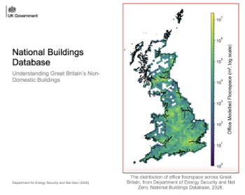
New UK National Buildings Database.
Building Safety Wiki Interviews

Chief executive of the British Woodworking Federation.
Planning condition discharge in England and Wales

A brief explanation from a building compliance expert, with further links.
Overheating guidance and tools for building designers

Guidance for dealing with element of building fabric control that have increasing importance.
Shading for housing, a design guide

From the Good Homes Alliance and British Blind and Shutter Association.
UK Standard Skills Classification (SSC)

A shared framework for describing skills needs.
Social media ban consultation comes to close

CIOB urges UK Government to consider social media’s role in careers guidance in ban debate.