


Boundaries to land and property

A boundary is a line that divides one area from another. It may also be called a border and defines the extent of one or more areas that are adjacent or in close proximity.
Boundaries can be defined physically by coastlines, rivers, roads, walls, fences and lines painted on the ground, or they can have no manifestation other than on maps, plans, charts and legal documentation. Boundaries between counties, administrative regions and nation states often appear only as lines on maps.
Boundaries are often the subject of disputes and may have perimeter security to prevent unauthorised access.
Title deed drawings tend to show which side of the boundary owns any physical structure such as a fence, using a ‘T’ symbol. Title deeds may also include agreements about ownership of, or responsibility for, boundaries, although these do not generally give any great detail, and are not always clear or accurate. For more information see: Responsibility for boundary features.
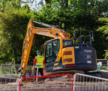
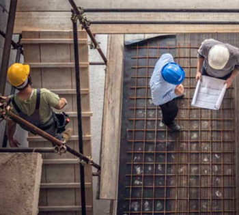
Construction sites often have strictly-defined boundaries comprising fences, hoardings and gates. These not only deter thieves and intruders, but also to protect the public from inadvertently straying into a potentially dangerous area.
The Construction (Design and Management) Regulations (the CDM Regulations) require the prevention of access by unauthorised persons to construction sites and that ‘… where necessary in the interests of health and safety, a construction site must, so far as is reasonably practicable, and in accordance with the level of risk posed, comply with either or both of the following; have its perimeter identified by suitable signs and be arranged so that its extent is readily identifiable; or be fenced off.’
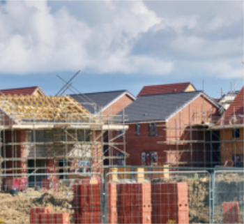
Buildings may be designed to extend right up to boundary lines or be limited by building regulations to be sited a minimum distance away. Where buildings adjoin one another, works to the party structure are controlled by the Party Wall Act.
NB The Scottish Building Standards, Part I. Technical Handbook – Domestic, Appendix A Defined Terms, suggests that:
'Boundary means a boundary between land on which the building is situated and land in different occupation, so however that:
- in relation to any road , whether public or private, public access way or public right of way, river, stream, canal, loch, pond, common land or a public open space it should be taken to mean the centre line thereof; and
- the sea and its foreshore should not be regarded as land in different occupation.'
NB Land measurement for planning and development purposes, Guidance Note, Global 1st edition, Published by the Royal Institution of Chartered Surveyors (RICS) in May 2021, suggests that a boundary is : ‘The edge of a title area using either of the following methods.’
- ‘Fixed boundary method: fixed boundaries are a key feature of cadastral systems. They are usually single points marked on the ground with stones, posts or metal, enabling the linear boundary between them to be determined. The type of demarcation is stated in the technical description of the cadastral survey. Coordinates, distances, bearings and areas are noted on the cadastral survey plan and mirrored on the cadastral index map.’
- ‘Determined boundary method: determined boundaries are a feature of land registration in the UK and some British Commonwealth countries, and are where boundaries identified under the ‘general boundaries’ principle are established on the ground and recorded. For example, in England and Wales the requirement is to record a boundary’s position to a precision of +/- 10mm. The determined boundary should be mapped relative to surrounding ‘hard’ detail (any feature made of brick, stone or concrete that is expected to endure) to a high level of accuracy that is certified by a chartered land surveyor. The intention is that another chartered land surveyor would be able to relocate the boundary. A determined boundary should be agreed between the neighbouring landowners before it is recorded in the land register.’
See also: General boundaries.
NB Approved document S, Infrastructure for the charging of electric vehicles, published in 2021 by HM Government, defines a boundary as: ‘The boundary of the land and/or buildings belonging to and under the control of the building owner.’
It defines the site boundary as: ‘The boundary of the land in relation to a building, in respect of which building work is being carried out, means the boundary of the land, upon which that building is situated, that is controlled or owned by the same person who owns:
- ‘that building, or
- in the case of the erection of a new building, the land upon which building work is being carried out.’
International Land Measurement Standard: Due Diligence for Land and Real Property Surveying, 1st edition, published by the International Land Measurement Standard Coalition in May 2019, defines a boundary as: ‘A line that marks the limits of an area. Boundaries can be a Physical Boundaries and Legal Boundaries, which are not all coincident and take many forms. This includes straight or curvilinear surfaces between known coordinated points or Physical Boundaries based on physical features.’
See also:
[edit] Related articles on Designing Buildings
Featured articles and news
RTPI leader to become new CIOB Chief Executive Officer

Dr Victoria Hills MRTPI, FICE to take over after Caroline Gumble’s departure.
Social and affordable housing, a long term plan for delivery
The “Delivering a Decade of Renewal for Social and Affordable Housing” strategy sets out future path.
A change to adoptive architecture
Effects of global weather warming on architectural detailing, material choice and human interaction.
The proposed publicly owned and backed subsidiary of Homes England, to facilitate new homes.

How big is the problem and what can we do to mitigate the effects?
Overheating guidance and tools for building designers

A number of cool guides to help with the heat.
The UK's Modern Industrial Strategy: A 10 year plan

Previous consultation criticism, current key elements and general support with some persisting reservations.
Building Safety Regulator reforms
New roles, new staff and a new fast track service pave the way for a single construction regulator.
Architectural Technologist CPDs and Communications
CIAT CPD… and how you can do it!
Cooling centres and cool spaces
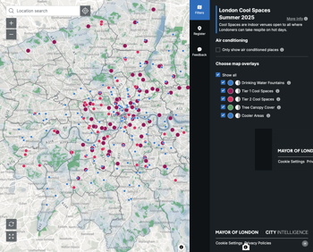
Managing extreme heat in cities by directing the public to places for heat stress relief and water sources.
Winter gardens: A brief history and warm variations

Extending the season with glass in different forms and terms.
Restoring Great Yarmouth's Winter Gardens

Transforming one of the least sustainable constructions imaginable.
Construction Skills Mission Board launch sector drive

Newly formed government and industry collaboration set strategy for recruiting an additional 100,000 construction workers a year.
New Architects Code comes into effect in September 2025
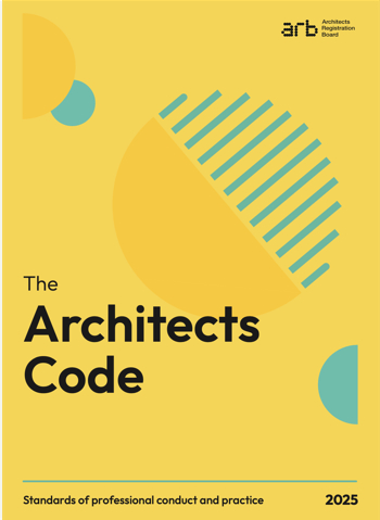
ARB Architects Code of Conduct and Practice available with ongoing consultation regarding guidance.
Welsh Skills Body (Medr) launches ambitious plan

The new skills body brings together funding and regulation of tertiary education and research for the devolved nation.
Paul Gandy FCIOB announced as next CIOB President

Former Tilbury Douglas CEO takes helm.
UK Infrastructure: A 10 Year Strategy. In brief with reactions

With the National Infrastructure and Service Transformation Authority (NISTA).
Comments
[edit] To make a comment about this article, or to suggest changes, click 'Add a comment' above. Separate your comments from any existing comments by inserting a horizontal line.