Datum
On a construction project, a datum level is an arbitrary horizontal plane of reference from which all vertical dimensions are measured. It can show the vertical height difference between floor levels of a building as well as differences in levels between one part of the site and another.
The datum on a site can be given a 0.000m designation but this does not have to necessarily be outside ground level; if it is, a ground floor may be at say, 0.750m and a first floor at 4.750 and so on proceeding up the building. In contrast, a basement which will be below ground will be below datum level and will therefore have a minus symbol prefixed to it e.g -3.250m.
However, minus signs can be easily misread, not seen or read as a dash, so can cause confusion. For this reason, a suitable fixed point (called a temporary benchmark – TBM) is assumed to ensure that all other levels are positive. So, in the case of the basement level referred to above, it may be given 0.000m as the site datum, in which case (following the logic from above) ground level = 3.250m; ground floor = 4.000m; first floor = 8.000m and so on. The levels usually refer to finished floor levels (FFL) but can also indicate other features e.g finished structural level (FSL)
Datum levels are useful as they provide points of reference to allow the vertical setting out of buildings and how they relate to other levels on a site. They should be clearly indicated on all relevant drawings with all levels described in metres to three decimal places but always as positive numbers because they are above datum level.
It is increasingly the case, especially for large projects, that the Ordnance Survey (OS) datum is used as a project datum as it allows work on the site to be related to other features in the area, e.g manholes and sewers, local gradients etc. Using this approach means that everything is to the same OS datum and OS grid (OSG).
Note: OS datum is taken as height above sea-level based on a known datum point at Newlyn, Cornwall; if the OS datum is being used, it must be indicated on the drawings. OSG is the standard known grid across the UK.
For more information see: Ordnance datum.
[edit] Other datums
A datum may also be a line from which all other horizontal dimensions relate to whether, on architectural or engineering drawings. An example is a building that has a plan generated from a back wall.
A datum may also be a point that is used for setting out the building. This must be clearly marked on drawings to help the contractor’s setting out. For example, a circular building will be set out from a datum point from which all radii are generated.
Drawing for Understanding, Creating Interpretive Drawings of Historic Buildings, published by Historic England in 2016 defines a datum line as: 'A horizontal or vertical reference line used to control height and horizontal distance measurements.'
The Geospatial Glossary, published by the Geospatial Commission, and accessed on 17 September 2022, defines horizontal datums as: ‘…a series of data points on the surface of the earth that are used to measure the position of oneself on the Earth’s surface.’
[edit] Related articles on Designing Buildings
- At grade.
- Data.
- Ordnance Survey.
- Origin point.
- Geographic information system GIS.
- Global positioning systems and global navigation satellite systems.
- Building height.
- International Property Measurement Standards.
- Invert.
- Location plan.
- Measurement.
- Ordnance datum.
- Setting out.
- Site plan.
- Water engineering.
Featured articles and news
Building Safety recap January, 2026
What we missed at the end of last year, and at the start of this...
National Apprenticeship Week 2026, 9-15 Feb
Shining a light on the positive impacts for businesses, their apprentices and the wider economy alike.
Applications and benefits of acoustic flooring
From commercial to retail.
From solid to sprung and ribbed to raised.
Strengthening industry collaboration in Hong Kong
Hong Kong Institute of Construction and The Chartered Institute of Building sign Memorandum of Understanding.
A detailed description fron the experts at Cornish Lime.
IHBC planning for growth with corporate plan development
Grow with the Institute by volunteering and CP25 consultation.
Connecting ambition and action for designers and specifiers.
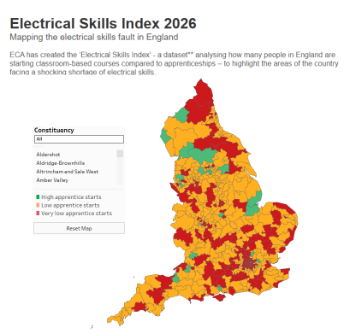
Electrical skills gap deepens as apprenticeship starts fall despite surging demand says ECA.
Built environment bodies deepen joint action on EDI
B.E.Inclusive initiative agree next phase of joint equity, diversity and inclusion (EDI) action plan.
Recognising culture as key to sustainable economic growth
Creative UK Provocation paper: Culture as Growth Infrastructure.
Futurebuild and UK Construction Week London Unite
Creating the UK’s Built Environment Super Event and over 25 other key partnerships.
Welsh and Scottish 2026 elections
Manifestos for the built environment for upcoming same May day elections.
Advancing BIM education with a competency framework
“We don’t need people who can just draw in 3D. We need people who can think in data.”
Guidance notes to prepare for April ERA changes
From the Electrical Contractors' Association Employee Relations team.
Significant changes to be seen from the new ERA in 2026 and 2027, starting on 6 April 2026.
First aid in the modern workplace with St John Ambulance.
Solar panels, pitched roofs and risk of fire spread
60% increase in solar panel fires prompts tests and installation warnings.
Modernising heat networks with Heat interface unit
Why HIUs hold the key to efficiency upgrades.


Comments