


Geophysical survey
Contents |
[edit] Introduction
A geophysical survey is a cost-effective, non-intrusive and relatively efficient means of detecting and assessing sub-surface features. Geophysical surveys are capable of covering large areas at low cost by taking readings between widely spaced borings to detect and locate changes in sub-surface materials or stratification. They are useful for extended sites where conditions are generally favourable and are widely-used in the support of planning applications.
There are a wide variety of geophysical techniques available for measuring different physical properties, with different levels of sensitivity to different types of feature. The site-specific conditions and the type and composition of likely features will determine the suitability of a particular technique.
The most commonly-used geophysical survey techniques:
- Electrical resistivity.
- Seismic refraction and reflection.
- Magnetometry.
- Ground-penetrating radar (GPR).
[edit] Electrical resistivity
Electrical resistivity surveys detect the difference in electrical resistance between different rock or soil types. They are able to detect features such as swallow holes or underground cavities, and analysis of the results can establish the thicknesses and depths of the various sub-strata.
The method involves passing a small electrical current through equally-spaced electrodes on the surface. By varying the electrode centres, the penetration depth can be varied. The recorded differences in relative resistance are used to map features such as voids, ditches, pits and structural features. This is useful in situations where magnetometry is unsuitable, however, it can be more time-consuming and problems can occur if conductors such as pipes and cables are present, as these can make the survey results unreliable.
[edit] Seismic refraction and reflection
Seismic refraction and reflection involves propagating vibrations with a ‘sledgehammer’ and measuring the time taken and the distance covered by the shock waves. Shallow exploration tends to favour the refraction method, whereby seismometers are spaced at increasing distances from the vibration source with the shock waves plotted against a time scale.
The reflection method is suited to exploration depths of greater than 150 m. Both methods are useful for determining the change in soil type and for surveying sites for tunnels, dams and harbour works.
[edit] Magnetometry
Magnetometry is based on measuring the variations in intensity and direction of the earth’s magnetic field and is capable of providing a rapid, detailed assessment of a large area. Anomalies in the vertical component of the earth’s magnetic field can be detected, which can identify and locate underground cavities, building remains, pits, and buried objects such as cables and pipelines.
[edit] Ground-penetrating radar (GPR)
A radar signal is directed at the ground, and the time take for reflection to reach the detector can be used to map the depth of sub-surface features. It can be used for deep objects and can identify small features, but is generally best suited to good ground conditions.
[edit] Related articles on Designing Buildings Wiki
- 3D laser survey.
- Alluvium.
- Condition survey.
- Desk study.
- Ecological survey for design and construction.
- Environmental Impact Assessment.
- Geotechnical engineering.
- Ground conditions.
- Ground improvement techniques.
- Ground investigation.
- In situ testing of soils.
- Interferometric synthetic aperture radar InSAR.
- Interview with Elly Ball, co-founder Get Kids into Survey.
- Land surveying.
- Minerals surveyor.
- Preliminary ecological appraisal.
- Radar.
- Soil report.
- Soil survey.
- Subsoil.
- Surveying instruments.
- Testing construction materials.
- Testing pile foundations.
- Thermographic survey of buildings.
- Topsoil.
- Trial pit.
- Types of soil.
- Using satellite imagery to monitor movements in megaprojects.
- Walkover survey.
[edit] External references
- ‘Introduction to Civil Engineering Construction’ (3rd ed.), HOLMES, R., The College of Estate Management (1995)
Featured articles and news
The UK's Modern Industrial Strategy: A 10 year plan

Previous consultation criticism, current key elements and general support with some persisting reservations.
Building Safety Regulator reforms
New roles, new staff and a new fast track service pave the way for a single construction regulator.
Architectural Technologist CPDs and Communications
CIAT CPD… and how you can do it!
Cooling centres and cool spaces
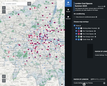
Managing extreme heat in cities by directing the public to places for heat stress relief and water sources.
Winter gardens: A brief history and warm variations

Extending the season with glass in different forms and terms.
Restoring Great Yarmouth's Winter Gardens

Transforming one of the least sustainable constructions imaginable.
Construction Skills Mission Board launch sector drive

Newly formed government and industry collaboration set strategy for recruiting an additional 100,000 construction workers a year.
New Architects Code comes into effect in September 2025

ARB Architects Code of Conduct and Practice available with ongoing consultation regarding guidance.
Welsh Skills Body (Medr) launches ambitious plan

The new skills body brings together funding and regulation of tertiary education and research for the devolved nation.
Paul Gandy FCIOB announced as next CIOB President

Former Tilbury Douglas CEO takes helm.
UK Infrastructure: A 10 Year Strategy. In brief with reactions

With the National Infrastructure and Service Transformation Authority (NISTA).

Ebenezer Howard: inventor of the garden city. Book review.
The Grenfell Tower fire, eight years on
A time to pause and reflect as Dubai tower block fire reported just before anniversary.
Airtightness Topic Guide BSRIA TG 27/2025
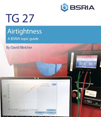
Explaining the basics of airtightness, what it is, why it's important, when it's required and how it's carried out.
Construction contract awards hit lowest point of 2025

Plummeting for second consecutive month, intensifying concerns for housing and infrastructure goals.
Understanding Mental Health in the Built Environment 2025

Examining the state of mental health in construction, shedding light on levels of stress, anxiety and depression.