Updated seismic hazard maps for the UK
A 2020 report presents new national seismic hazard maps for the UK that have been developed to update the advice given to engineers about designing structures for earthquake resistance.
|
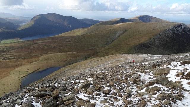
| Snowdonia is a part of the UK with the highest seismic activity. |
Contents |
[edit] Introduction
Although historical observations dating back several centuries show that damaging earthquakes are relatively rare in the UK, they do occur, so it is important to quantify the hazard they pose to the built environment. Seismologists from the British Geological Survey (BGS) have recently completed a new seismic hazard assessment for the UK.
View a seismic hazard map of the UK here.
This has been undertaken with support from the ICE Research and Development Enabling Fund, other seismologists and engineers based in the UK, and oversight from the British Standard Institution (BSI) sub-committee B/525/8 for Eurocode 8 (EC8): Earthquake resistant design of structures. The context is a complete revision of EC8, now nearing completion.
The seismic hazard is computed using a model that aims to characterise the relevant earthquake processes and effects in a region. It consists of two parts: one that characterises earthquake occurrence (where they occur and their frequency of occurrence, sometimes referred to as the seismic source characterisation model) and another that describes the ground shaking that may result from potential future earthquakes (the ground motion characterisation component).
The model is based on historical and instrumental observations of earthquakes and their effects, and information and data relating to the tectonics and geological structure of the UK region. The modelling must also try to capture the uncertainty relating to both the natural randomness of the earthquake process and to limited data and knowledge about different aspects of earthquakes and their effects. This is a particular challenge in low seismicity regions.
The new seismic hazard maps are given for three ground motion measures: peak ground acceleration and spectral acceleration at 0.2 s and 1.0 s (assuming 5% damping). They show these results for rock conditions (VS = 800 m/s) and have been computed for four return periods: 95, 475, 1100 and 2475 years. These return periods correspond to probabilities of exceedance of approximately 41%, 10%, 5% and 2%, respectively, of exceeding a particular level of ground motion in a 50-year period. The maps confirm that seismic hazard is generally low in the UK but that the hazard is slightly higher in areas like Wales and north central England. This largely reflects the higher rates of historical earthquake activity in these regions.
[edit] Designing for earthquake resistance in the UK
The new maps have important implications for the consulting engineering community, particularly those involved with projects involving a higher than usual consequences of failure – the ‘consequence class’ in Eurocode language.
The new maps give parameters that are directly related to those in the new draft of EC8. This enables a comparison of UK seismic hazard levels with the threshold level recommended by EC8 above which consideration of seismic design becomes advisable. For almost all ‘standard’ consequence class structures, the new maps suggest that the threshold is unlikely to be crossed.
Since this threshold level is a recommendation which can be adjusted nationally, the UK will over the next year or two have to decide whether the exemption for ‘standard’ structures will be applied to the UK as whole, as is presently recommended in a BSI document (PD6988) dated 2013, which refers to the current version of EC8. For higher consequence classes, particularly in the areas of higher-than-average seismic hazard, and for sites underlain by soft soils, some projects might need to consider whether a degree of seismic design is needed; this might apply to projects such as a large hospital providing emergency care, a vital transportation link or a manufacturing facility particularly sensitive to ground vibrations.
The highest consequence class – CC4 – is not fully covered by the Eurocodes, and projects, particularly those in the nuclear power industry, are in any case covered by separate legislation and procedures.Here, the new seismic hazard maps are not directly usable, because there needs to be a site-specific assessment of seismic hazard extending to very long return periods, rather than the regional approach appropriate for maps. Even in this case, the extensive review of the sources of seismicity in the UK and its surroundings, and the use of up-to-date methods of assessment in the development of these maps, may well prove valuable.
[edit] Resources
A report describing the development of the maps, the data used in the modelling, and the model itself, is available from the BGS website. You can also download files containing the results and high-resolution versions of the maps from this page.
This article originally appeared on 30 November 2020 in ICE’s The Civil Engineer Blog. It was written by Brian Baptie, Edmund Booth, Ilaria Mosca and Susanne Sargeant.
--The Institution of Civil Engineers
[edit] Related articles on Designing Buildings Wiki
- After Mexico - earthquakes and resilient cities.
- Earthquakes and the seismic strengthening of churches.
- Earthquake Design Practice for Buildings.
- Engineers and hurricanes.
- How to rebuild using the debris from disasters.
- Hurricane design considerations.
- ICE articles.
- Managing and responding to disaster.
- The Institution of Civil Engineers.
Featured articles and news
UKCW London to tackle sector’s most pressing issues
AI and skills development, ecology and the environment, policy and planning and more.
Managing building safety risks
Across an existing residential portfolio; a client's perspective.
ECA support for Gate Safe’s Safe School Gates Campaign.
Core construction skills explained
Preparing for a career in construction.
Retrofitting for resilience with the Leicester Resilience Hub
Community-serving facilities, enhanced as support and essential services for climate-related disruptions.
Some of the articles relating to water, here to browse. Any missing?
Recognisable Gothic characters, designed to dramatically spout water away from buildings.
A case study and a warning to would-be developers
Creating four dwellings... after half a century of doing this job, why, oh why, is it so difficult?
Reform of the fire engineering profession
Fire Engineers Advisory Panel: Authoritative Statement, reactions and next steps.
Restoration and renewal of the Palace of Westminster
A complex project of cultural significance from full decant to EMI, opportunities and a potential a way forward.
Apprenticeships and the responsibility we share
Perspectives from the CIOB President as National Apprentice Week comes to a close.
The first line of defence against rain, wind and snow.
Building Safety recap January, 2026
What we missed at the end of last year, and at the start of this...
National Apprenticeship Week 2026, 9-15 Feb
Shining a light on the positive impacts for businesses, their apprentices and the wider economy alike.
Applications and benefits of acoustic flooring
From commercial to retail.
From solid to sprung and ribbed to raised.
Strengthening industry collaboration in Hong Kong
Hong Kong Institute of Construction and The Chartered Institute of Building sign Memorandum of Understanding.
A detailed description from the experts at Cornish Lime.


