


Real time kinematic RTK
Contents |
[edit] Introduction
Real time kinematic (RTK) is a surveying technology used by drones to make real time corrections to images captured by global positioning systems (GPS) and other Global Navigation Satellite Systems (GNSS). The other type of correction technology is known as post processed kinematic or PPK, which corrects location data after it has been collected and uploaded.
[edit] Correction technology background
Both RTK and PPK GPS correction technologies are effective at capturing pinpoint location information. They are believed to be improvements over the use of ground control points (GCPs), which is the traditional method of capturing this information. A GCP is a location or object with known coordinates that is used as a reference point for surveying purposes.
Both forms of GPS correction technology are incorporated directly into drone equipment.
[edit] Capabilities of RTK
RTK technology is suitable for flat areas where obstructions are minimal. This is important, since trees, mountains or other projects can disrupt communications. Since RTK relays information in real time, it requires reliable connectivity in order to send the information steadily. An interrupted connection can disrupt the data capture and transmission process and create gaps.
It is possible for an RTK user to obtain 2 cm level positioning in plan, and even better if they are careful. With RTK, the distance from the reference station can have an impact on the final positional accuracy that can be achieved.
[edit] Networked RTK
A technique known as networked RTK has developed which links together data from a number of dual frequency GPS receivers in real time – providing RTK correction solution or a regional differential code GPS (dGPS). Examples of networked RTK systems are the commercial services built on the Ordnance Survey OS Net™ national GPS infrastructure.
Non-networked RTK relies on a single base-station receiver and a number of mobile units. However, with networked RTK there is no need to set up a local base station and the accuracy is not dependent on the base-to-rover receiver distance. This can sometimes result in cost savings measures.
[edit] Related articles on Designing Buildings
- Construction drones.
- Geographic information system GIS.
- Geospatial.
- Global positioning systems and global navigation satellite systems.
- Ground control point GCP.
- Interview with Elly Ball, co-founder Get Kids into Survey.
- Land surveying.
- Post processed kinematic PPK.
- Surveying instruments.
- Uses of drones in construction.
- Using satellite imagery to monitor movements in megaprojects.
Featured articles
Check out some of the best features and news from Designing Buildings as well as key stories from around the web.

The hidden risk in modern construction supply chains.
Construction Management, 10 June

24 months to 14: CITB launches accelerated apprenticeships.
Bridging the gap between clients and contractors

Concerns remain around contractor quality, capability, and delivery.
Construction Management, 10 June.
Heat pumps beat boilers in new home tests.
Building Safety Act implementation in Wales

CIAT to host industry panel on 26 June.
![]()
New and updated CLC building safety guidance.
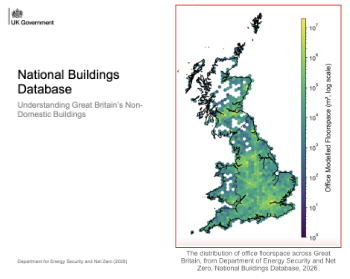
New UK National Buildings Database.
Building Safety Wiki Interviews

Chief executive of the British Woodworking Federation.
Planning condition discharge in England and Wales

A brief explanation from a building compliance expert, with further links.
Overheating guidance and tools for building designers

Guidance for dealing with element of building fabric control that have increasing importance.
Shading for housing, a design guide

From the Good Homes Alliance and British Blind and Shutter Association.