QGIS "What about Learning More?"
|
• Screenshot of panel with link to article on Wikipedia |
[edit] FOREWORD"We will be showing you how to use QGIS easily and efficiently. If you are new to GIS, we will tell you what you need to get started. If you are an experienced user, you will see how QGIS fulfills all the functions you expect from a GIS program, and more!" |
[edit] INTRODUCTION
The aim of the QGIS Training Manual is:—
"...to provide all the materials needed to run a 5 day course on QGIS, PostgreSQL and PostGIS. The course is structured with content to suit novice, intermediate and advanced users alike and has many exercises complete with annotated answers throughout the text."
(ib.)
The objects of this particular article are:—
- To understand the basics of the QGIS user interface.
- To get started with an example map.
- Learn how to use Pan and Zoom tools within QGIS and learn about map scale.
- To be able to create any symbology you want for any vector layer.
It is therefore structured with content from Module 2 to suit novice users.
• Table 1: Complete list of Modules contained in the official documentation of QGIS. See Appendix for further details.
[edit] • 2. Module: Creating and Exploring a Basic Map (Beginner-level 2.1 - 2.4.4.)
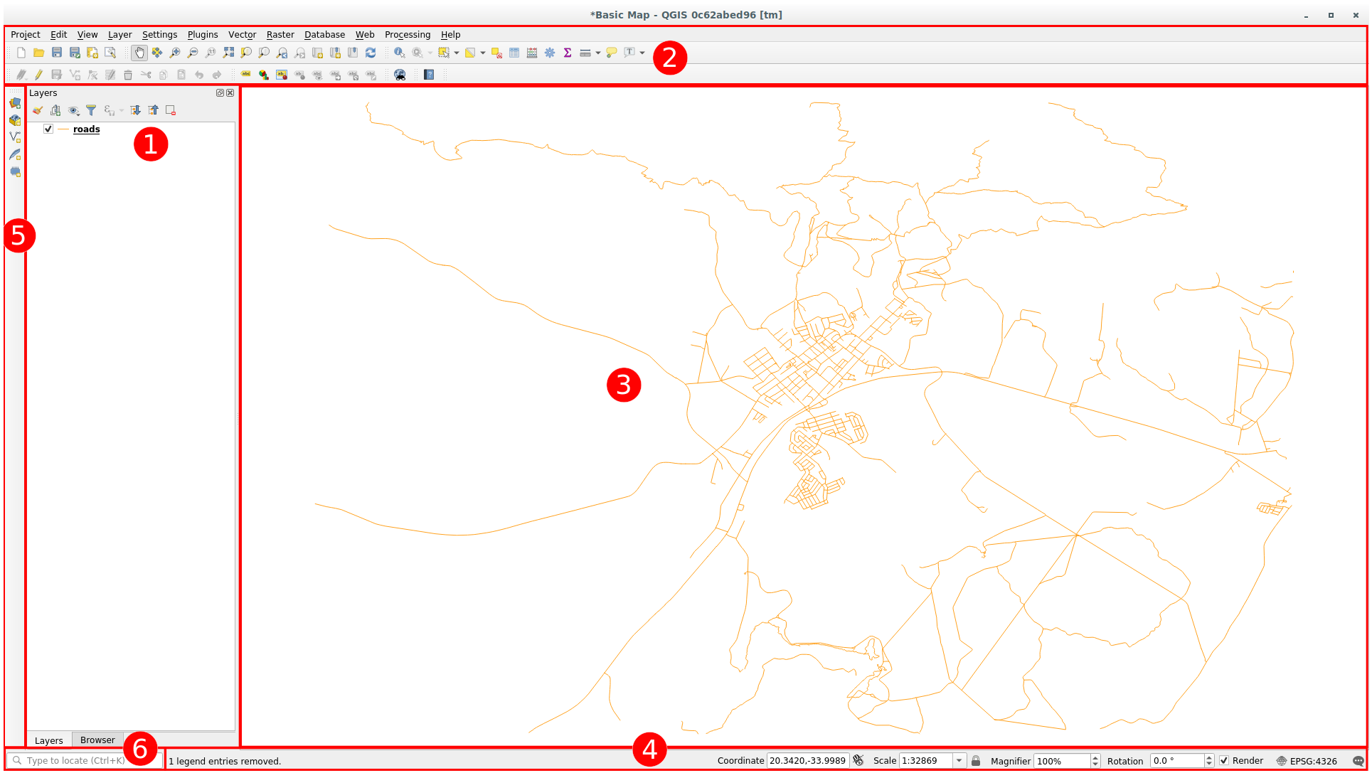
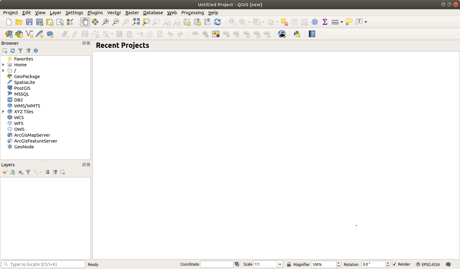
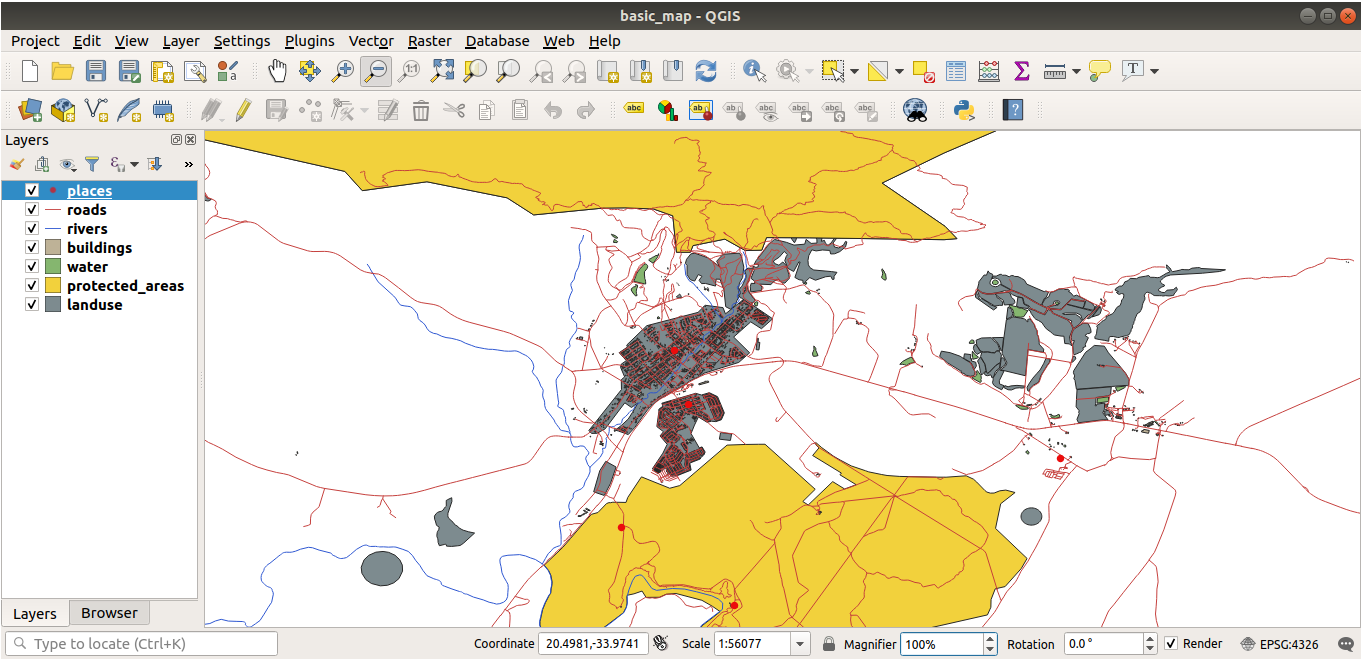
[edit] • 2.1. Lesson: An Overview of the InterfaceGoal: To understand the basics of the QGIS user interface.
|
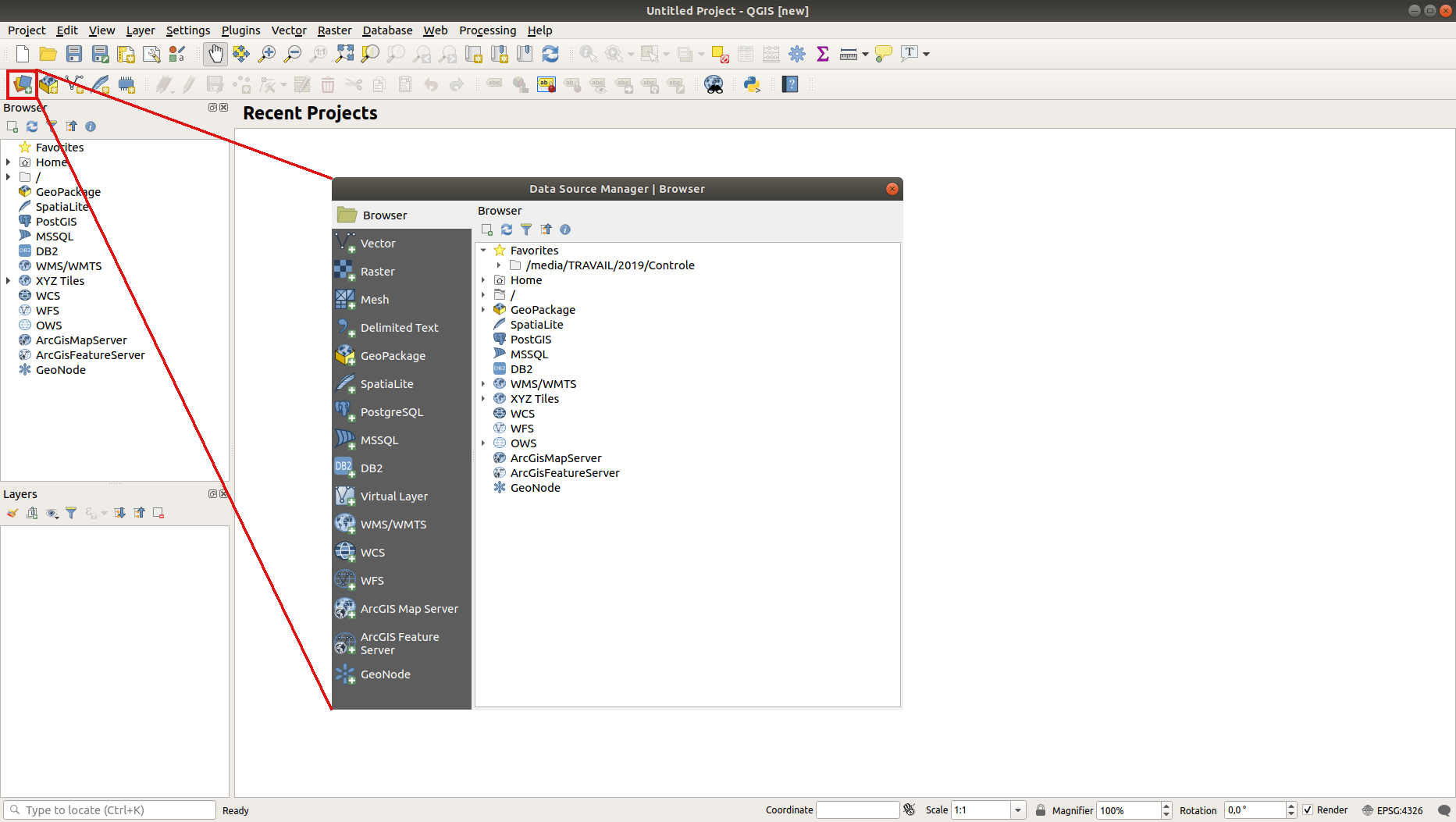
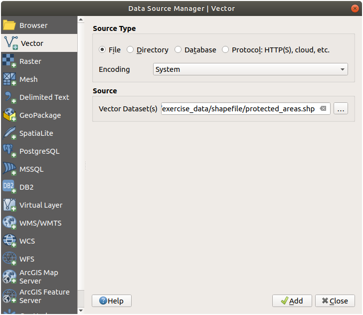
[edit] • 2.2. Lesson: Adding your first layers
Goal: To get started with an example map.
|
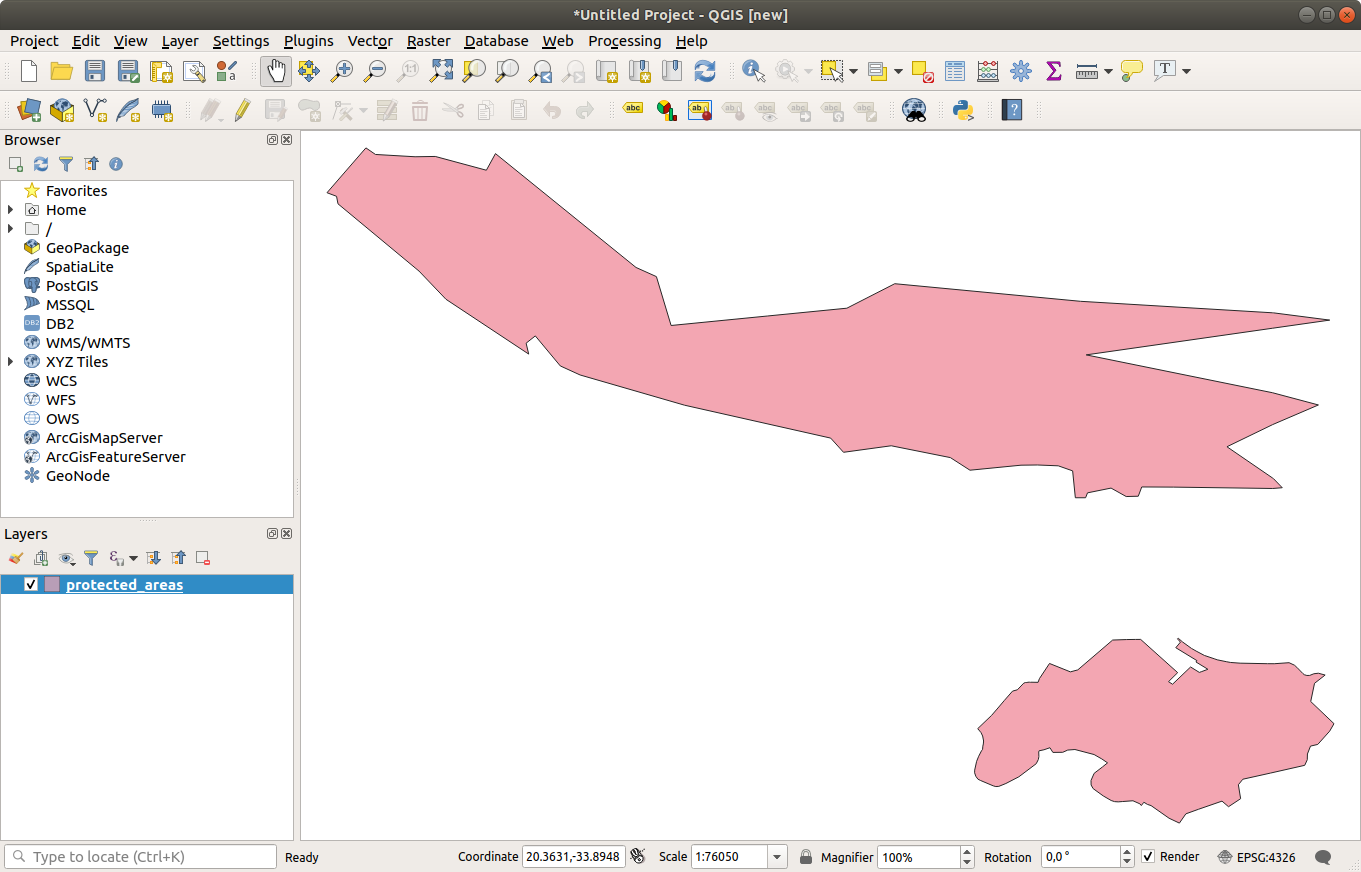
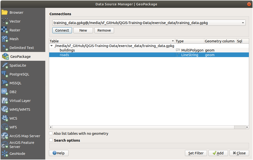
• 2.2.2. Try Yourself: |
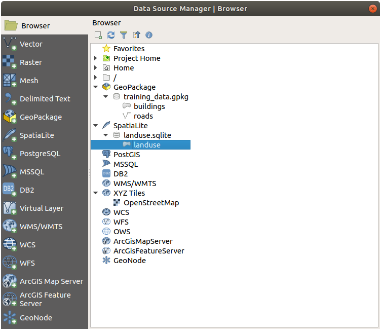
• 2.2.4. Loading vector data from a SpatiaLite Database with the Browser • 2.2.5. Try Yourself: |
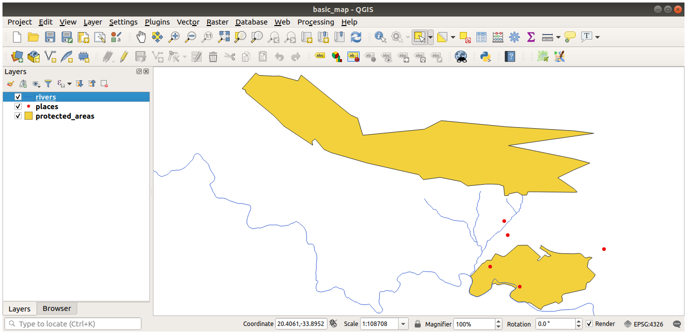
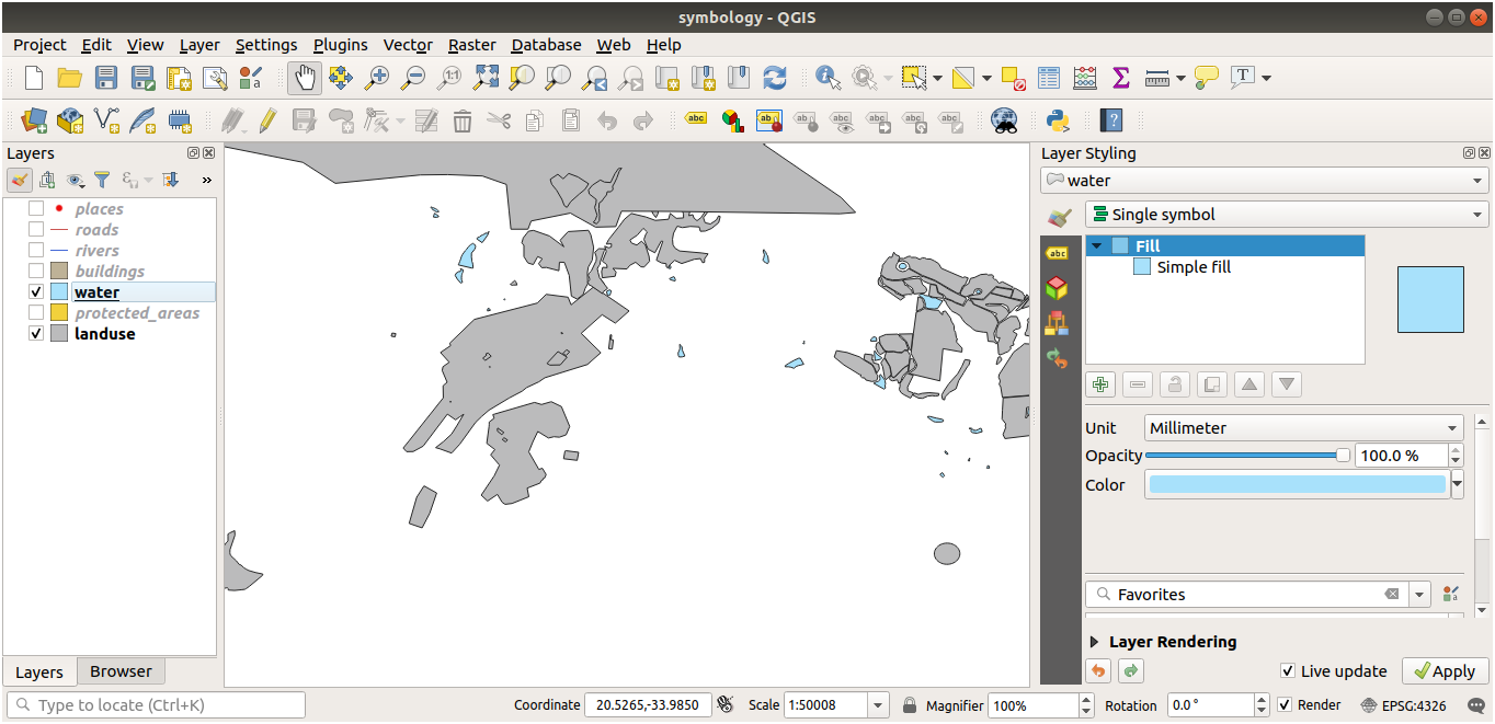
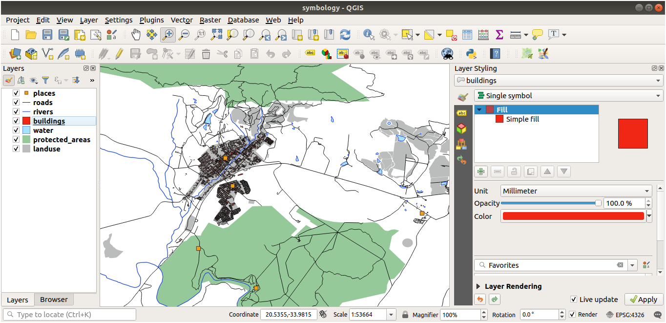
• 2.2.6. Reordering the layers n.b The map now makes more sense visually, with roads and buildings appearing above the land use regions. |
• Table 2.2: Outlining the main points involved in creating an example map.
[edit]
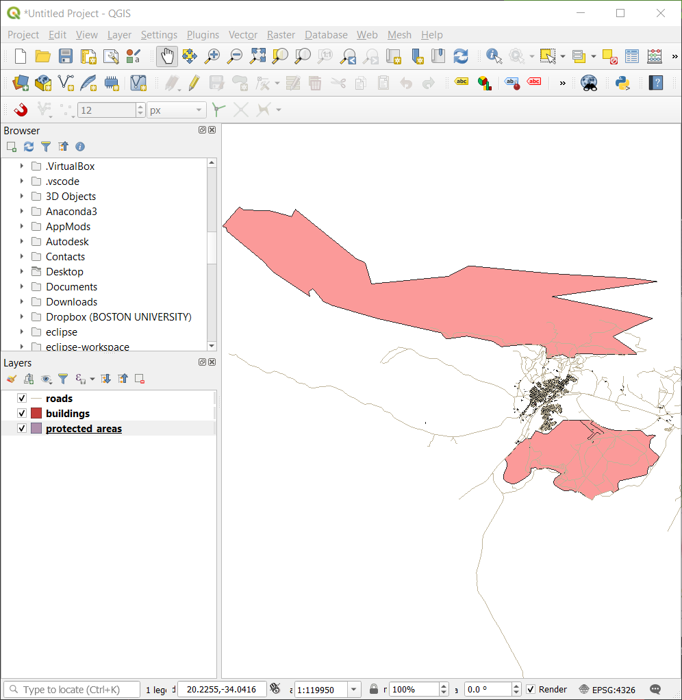
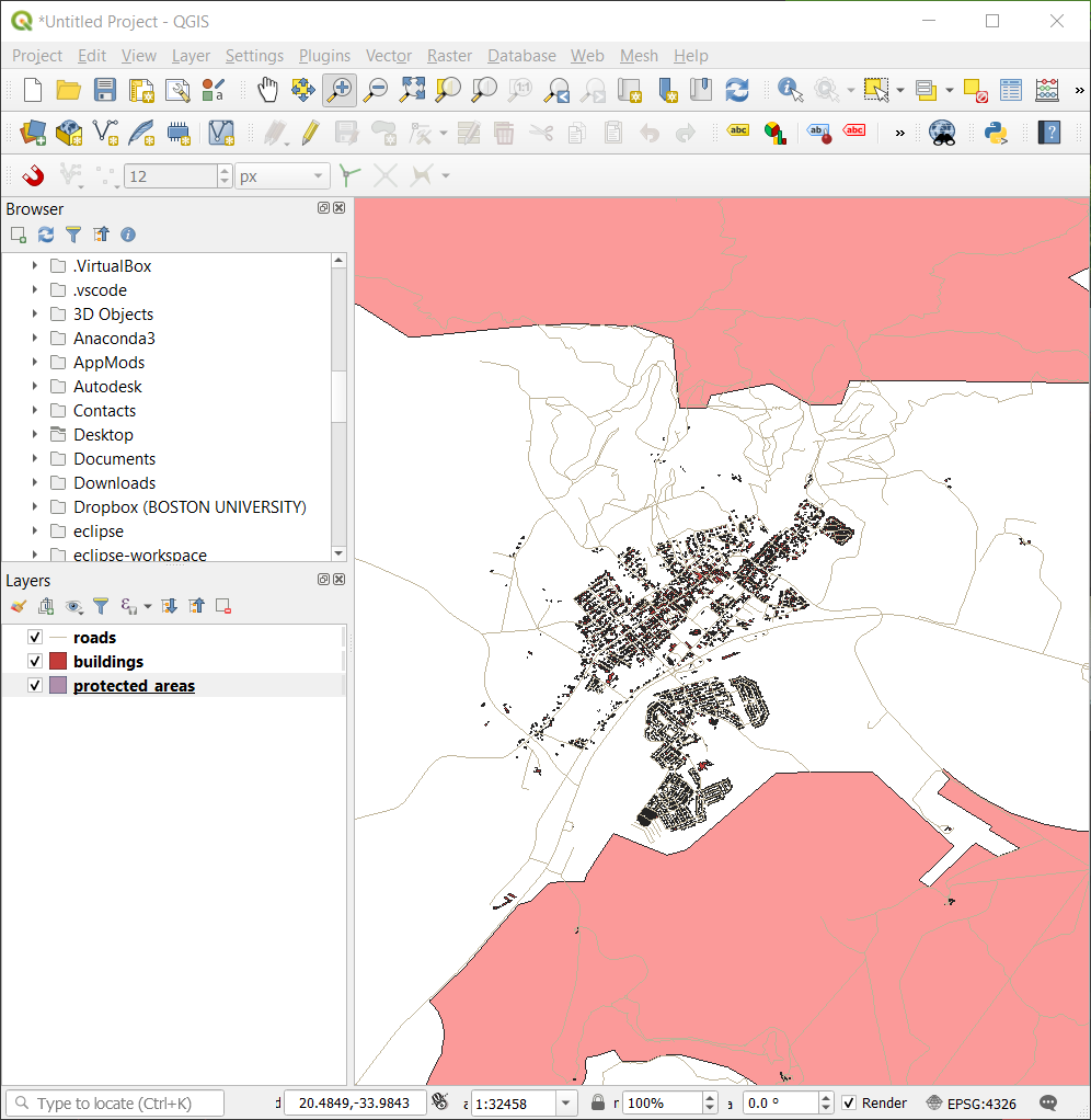
Goal: Learn how to use Pan and Zoom tools within QGIS and learn about map scale.
|
Fig. 2.8 Protected areas, roads and buildings added • 2.3.1. Basic Navigation Tools |
Fig. 2.9 Zoom in |
Fig. 2.10 Zoom out |
• Table 2.3: Outlining the main points involved in navigating the map canvas.
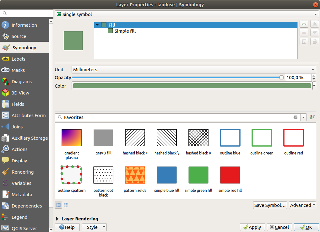
[edit] • 2.4. Lesson: Symbology
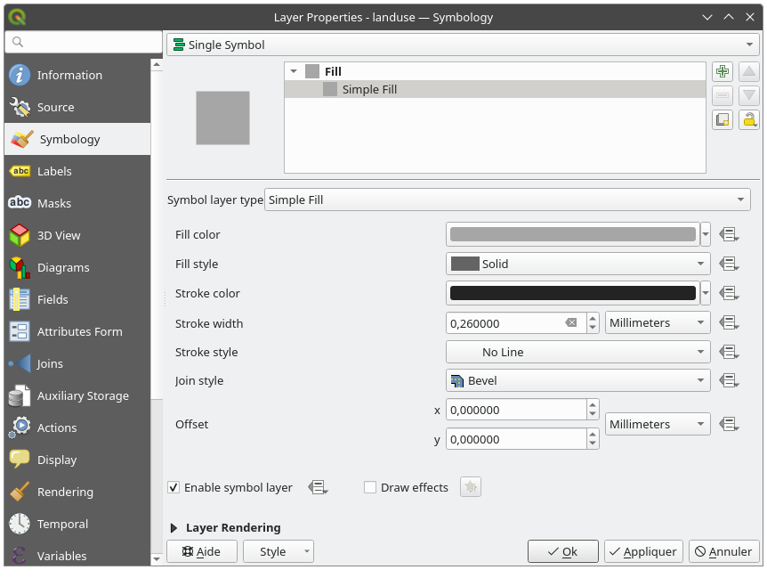
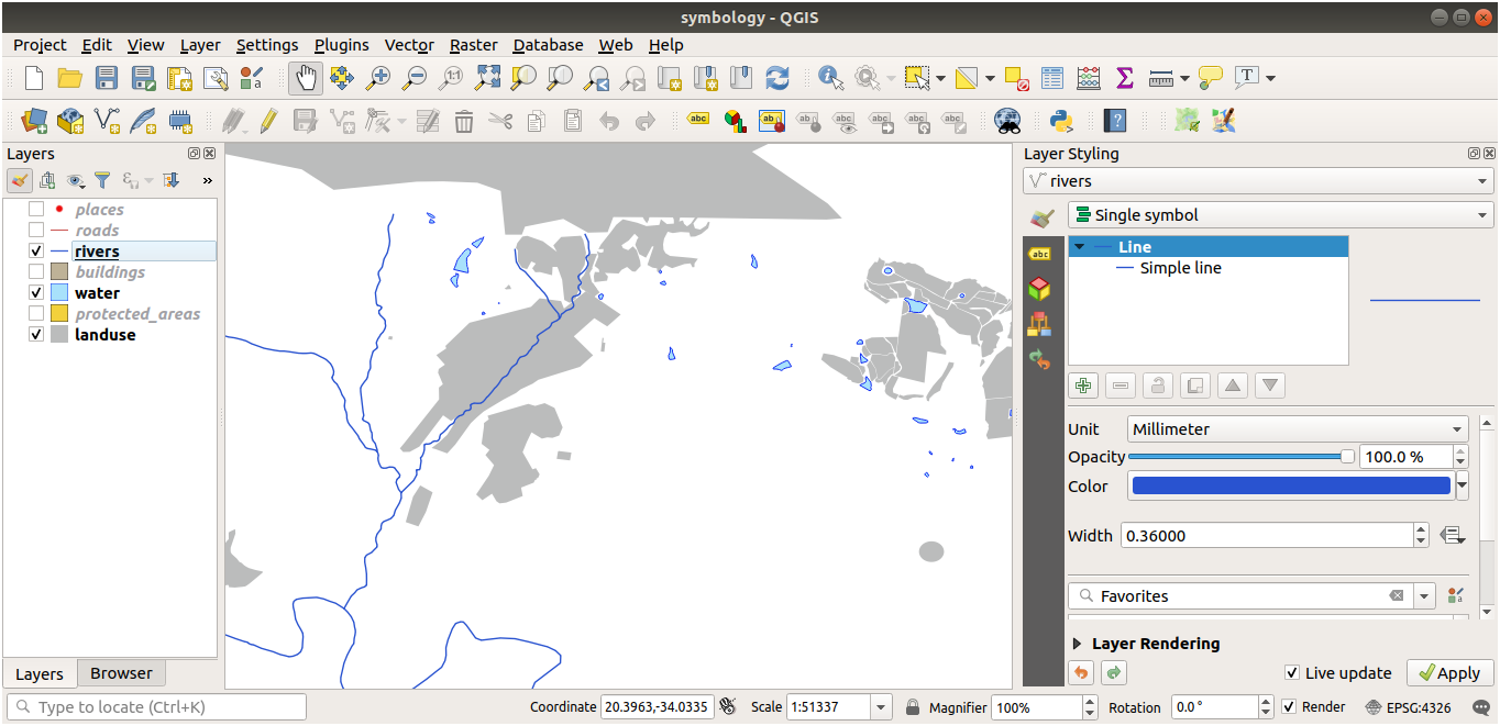
Goal: To be able to create any symbology you want for any vector layer.
|
• 2.4.1. Changing Colors |
• 2.4.2 Try Yourself |
• 2.4.4. Try Yourself |
• 2.4.4. (continuation) |
• Table 2.4: Outlining the main points involved in creating symbology.
[edit] CONCLUSION
The next step is to continue with Module 2.4.5. Scale-Based Visibility.
[edit] APPENDIX
The complete list of the Modules contained in the official documentation together with the goals for each lesson.
|
[edit] References
QGIS (2002-now) 'QGIS Training Manual', QGIS Project.
[edit] Further reading
Gandhi, U. (2022) 'Introduction to QGIS (Full Course Material): A Comprehensive Introduction to Mapping and Spatial Analysis with QGIS', Spatial Thoughts.
Gandhi, U. (2023) 'Web Mapping with QGIS2Web (QGIS3)', qgistutorials.com
[edit] Useful links
AMDGS (2018) 'QGIS 3 in 3 minutes', YouTube.
AMDGS (2019) 'QGIS 3: An introduction for beginners, upgraders and switchers', YouTube (see Playlist of 17 videos).
Learn & Explore (2023) 'Export Coordinates of Vertices from a Polygon Shapefile using QGIS', YouTube.
Archiblog (2024) 'QGIS - Selfried', Playlist of QGIS videos by Rebecca Selfried, YouTube.
--Archiblog 08:03, 19 May 2024 (BST)
[edit] Related articles on Designing Buildings
Geographic information system GIS
Geographic Information Systems: QGIS
Featured articles and news
Building Safety recap January, 2026
What we missed at the end of last year, and at the start of this...
National Apprenticeship Week 2026, 9-15 Feb
Shining a light on the positive impacts for businesses, their apprentices and the wider economy alike.
Applications and benefits of acoustic flooring
From commercial to retail.
From solid to sprung and ribbed to raised.
Strengthening industry collaboration in Hong Kong
Hong Kong Institute of Construction and The Chartered Institute of Building sign Memorandum of Understanding.
A detailed description fron the experts at Cornish Lime.
IHBC planning for growth with corporate plan development
Grow with the Institute by volunteering and CP25 consultation.
Connecting ambition and action for designers and specifiers.
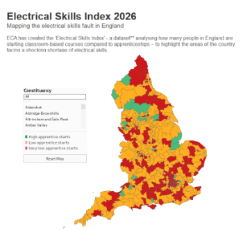
Electrical skills gap deepens as apprenticeship starts fall despite surging demand says ECA.
Built environment bodies deepen joint action on EDI
B.E.Inclusive initiative agree next phase of joint equity, diversity and inclusion (EDI) action plan.
Recognising culture as key to sustainable economic growth
Creative UK Provocation paper: Culture as Growth Infrastructure.
Futurebuild and UK Construction Week London Unite
Creating the UK’s Built Environment Super Event and over 25 other key partnerships.
Welsh and Scottish 2026 elections
Manifestos for the built environment for upcoming same May day elections.
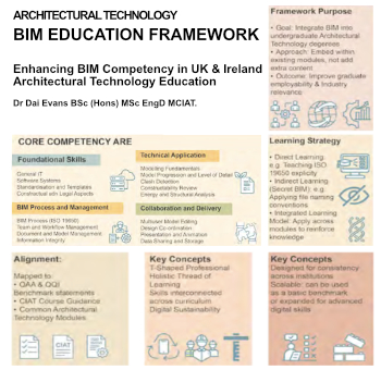
Advancing BIM education with a competency framework
“We don’t need people who can just draw in 3D. We need people who can think in data.”
Guidance notes to prepare for April ERA changes
From the Electrical Contractors' Association Employee Relations team.
Significant changes to be seen from the new ERA in 2026 and 2027, starting on 6 April 2026.
First aid in the modern workplace with St John Ambulance.
Solar panels, pitched roofs and risk of fire spread
60% increase in solar panel fires prompts tests and installation warnings.
Modernising heat networks with Heat interface unit
Why HIUs hold the key to efficiency upgrades.


