Urban Archaeological Databases
Deposit Modelling and Archaeology, Guidance for Mapping Buried Deposits, published by Historic England on 31 January 2020, suggests that Urban Archaeological Databases (UADs): ‘…provide detailed Historic Environment Record coverage for areas that have rich and complex below-ground archaeology; they have been created so far (2020) for about 30 historic towns and cities across England. They provide descriptions and maps of all individual pieces of archaeological work (‘Events’) which have taken place within a defined geographical area, along with a summary of all the ‘Monuments’ which have been identified by that work.’
[edit] Related articles on Designing Buildings Wiki
Featured articles and news
Recognising culture as key to sustainable economic growth
Creative UK Provocation paper: Culture as Growth Infrastructure.
Futurebuild and UK Construction Week London Unite
Creating the UK’s Built Environment Super Event and over 25 other key partnerships.
Welsh and Scottish 2026 elections
Manifestos for the built environment for upcoming same May day elections.
Advancing BIM education with a competency framework
“We don’t need people who can just draw in 3D. We need people who can think in data.”
Guidance notes to prepare for April ERA changes
From the Electrical Contractors' Association Employee Relations team.
Significant changes to be seen from the new ERA in 2026 and 2027, starting on 6 April 2026.
First aid in the modern workplace with St John Ambulance.
Ireland's National Residential Retrofit Plan
Staged initiatives introduced step by step.
Solar panels, pitched roofs and risk of fire spread
60% increase in solar panel fires prompts tests and installation warnings.
Modernising heat networks with Heat interface unit
Why HIUs hold the key to efficiency upgrades.
Reflecting on the work of the CIOB Academy
Looking back on 2025 and where it's going next.
Procurement in construction: Knowledge hub
Brief, overview, key articles and over 1000 more covering procurement.
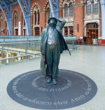
Sir John Betjeman’s love of Victorian church architecture.
Exchange for Change for UK deposit return scheme
The UK Deposit Management Organisation established to deliver Deposit Return Scheme unveils trading name.
A guide to integrating heat pumps
As the Future Homes Standard approaches Future Homes Hub publishes hints and tips for Architects and Architectural Technologists.


