


Elevations

Contents |
[edit] What is orthographic projection?
Orthographic projection is a technique for drawing a three dimensional object in two dimensions, by ‘projecting’ its surfaces into a two dimensional representation, where the projection lines are orthogonal to (perpendicular to) the projection plane (that is, there is no foreshortening or perspective).
[edit] What are elevation drawings?
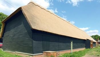
In the construction industry, the term ‘elevation’ refers to an orthographic projection of the exterior (or sometimes the interior) faces of a building, that is, a two-dimensional drawing of the building’s façades. An elevation drawing is a first angle projection that shows all parts of the building as seen from a particular direction with the perspective flattened. Generally, elevations are produced for four directional views, for example, north, south, east, west.
[edit] What should elevation drawings include?
Simple elevation drawings might show:
- The outline of a building.
- The exterior walls, and sometimes the finishes of the walls.
- Openings such as doors and windows.
- Roofing.
- Exterior features such as chimneys, decks, porches and steps.
- Any portion of the foundation that may be visible.
- Projections such as eves and rainwater pipes.
- Level datums such as finished ground level and floor positions.
- Key dimensions such as wall lengths and heights.
- A title block, including the name, number and revision of the drawing, the date of preparation, who the drawing was prepared by, project details, drawing scale, north point and so on.
However, they can contain a great deal more detail depending on the complexity of the buildings the reason for their preparation.
Insufficient information on elevations can mean that they do not properly satisfy the need for which they were prepared, however, very detailed elevations can be time-consuming and expensive to prepare and confusing to read. It is important therefore that the reason for the drawing is clear and the level of detail required satisfies that need.
[edit] What are elevations used for?
Elevations might be prepared for a number of reasons, including:
- As part of a survey of existing buildings.
- To create a record of an existing building.
- To explore and communicate interior and exterior design options.
- As part of an application for planning permission.
- As part of an application for building regulations approval.
- To communicate construction information.
- For sales and marketing.
[edit] How are elevations prepared?
Historically, buildings have been drawn by hand on two dimensional paper, and so orthogonal projection and the drawing of two dimensional plans and elevations have been the standard means of representation.
However, increasingly, buildings are being drawn using computer aided design (CAD) or building information modelling (BIM) software that represents them in three dimensions. Where these digital methods of drawing create 3d model of the building, two-dimensional elevations can be generated automatically from the 3D models, they do not need to be drawn individually.
[edit] Alternative meaning of elevation
The term 'elevation' might also be used to refer to the height of something above or below a fixed reference point or datum.
[edit] Related articles on Designing Buildings
- As-built drawings and record drawings
- Assembly drawing.
- Building information modelling.
- CAD layer.
- Computer aided design.
- Concept drawing.
- Detail drawing.
- Engineering drawing.
- Façade.
- Floor plan.
- General arrangement drawing.
- Notation and symbols.
- Orthogonal plan.
- Paper sizes.
- Principal elevation.
- Projections.
- Scale drawing.
- Standard hatching styles for drawings.
- Superelevation.
- Technical drawing.
- Techniques for drawing buildings.
- Types of drawings for building design.
- Working drawing.
[edit] External references
- The House Plans Guide – Elevation drawings
Featured articles
Check out some of the best features and news from Designing Buildings as well as key stories from around the web.

Government scraps pre-application consultation for Nationally Significant Infrastructure Projects.
Historic England and infrastructure
New projects offer opportunities for the historic environment and local communities.
Construction Management, 2 June

Construction deaths halve in two years.
Green Book changes to drive investment in all parts of UK.
Minimum energy efficiency standards (MEES)
![]()
CIAT briefing on response to consultations for privately rented non-domestic properties.
Connect, collaborate, shape the future

Registration now live for UK Construction Week Birmingham.
![]()
CIOB announces Saul Humphrey FCIOB as new President for 26/27 term.
![]()
A quick, simple, and zero-bills solution to prevent overheating.
The adaptive reuse of large industrial structures.

Promoting the circular economy by extending the life of buildings.
CIAT responds to Climate Change Committee report

An urgent wake-up call for both government and the built environment.
Construction Management, 24 June

FMB pilot aims to build pipeline of site-ready tradespeople.

A quick introduction.
Comments
[edit] To make a comment about this article, or to suggest changes, click 'Add a comment' above. Separate your comments from any existing comments by inserting a horizontal line.