


File:Openbim and gis integration.jpg
Size of this preview: 800 × 460 pixels

Contents |
[edit] Introduction
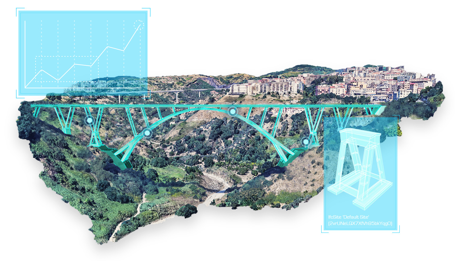
usBIM.geotwin is an innovative solution to create and manage Geospatial Digital Twins by integrating GIS data with openBIM IFC models.
Based on a dynamic and bidirectional integration between openBIM and GIS system, it has no limits in the management of digital twins.
It was first released in 2022 by ACCA software. It is currently available in Italian, English, French, Portuguese, Spanish and German.
It can be used in combination with the other apps integrated in the usBIM system.
[edit] Capabilities
By combining GIS geospatial data and BIM technology, geospatial digital twins can:
- provide a complete view of the current status of the project;
- offer powerful simulation tools to accurately prepare for the occurrence of potential problems and to take appropriate
- corrective measures;
- allow informed decisions on investment and infrastructure development.
- create spatial queries on the GIS;
- visualise of the 2D and 3D shapes of the BIM model of the construction and the model itself.
- display, directly from the geospatial view, the details of architectural, structural, building or infrastructure model federations and IFC properties with all its data.
- reproduce all the BIM information to the GIS model for geospatial queries
- provide the maintenance operations on each individual model, the properties of each individual asset, the active maintenance tickets, the activities performed on each object.
[edit] Utilities
The software main utilities include the below:
- accessible information directly from the GIS view (geometric data, design information, Asset management data, Facilities Management, IoT)
- production of real-time detailed data of any kind to the GIS system.
- creation of integrated and collaborative workflows;
- optimisation of asset management in every phase of the work life cycle.
- monitoring of the status of complex infrastructure systems to prevent dangerous situations.
[edit] What is a geospatial digital twin?
A geospatial digital twin is a digital model of an environment, asset, building, infrastructure, etc. enhanced with geospatial data.
GIS technology is used to create a scaled digital replica of the physical environment, including buildings, roads and bridges.
The integrated vision provided by geospatial digital twins can be used to improve the design and decision-making
process in numerous sectors, including for example asset management, urban planning, infrastructure monitoring.
[edit] Related articles on Designing Buildings Wiki
- Digital twin
- Artificial intelligence and civil engineering.
- Big data.
- BIM.
- Blockchain.
- Connected digital twins.
- Defining the digital twin: seven essential steps.
- Digital Roads 2025.
- Engineering Smart Cities.
- Internet of things.
- Interoperability.
- Making the most of big data.
- Open data.
- Smart technology.
- Twin cities.
- What a digital twin could be.
[edit] External references
GIS digital twin usBIM.geotwin - ACCA software
File history
Click on a date/time to view the file as it appeared at that time.
| Date/Time | Thumbnail | Dimensions | User | Comment | |
|---|---|---|---|---|---|
| current | 08:01, 25 July 2023 | | 1,500 × 862 (699 KB) | Vivtara (Talk | contribs) |
- Edit this file using an external application (See the setup instructions for more information)
File usage
The following 2 pages link to this file:
BIM Directory
[edit] Building Information Modelling (BIM)
[edit] Information Requirements
Employer's Information Requirements (EIR)
Organisational Information Requirements (OIR)
Asset Information Requirements (AIR)
[edit] Information Models
Project Information Model (PIM)
[edit] Collaborative Practices
Industry Foundation Classes (IFC)